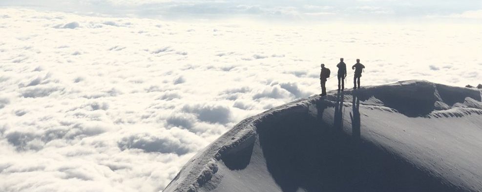
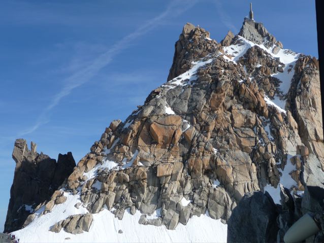
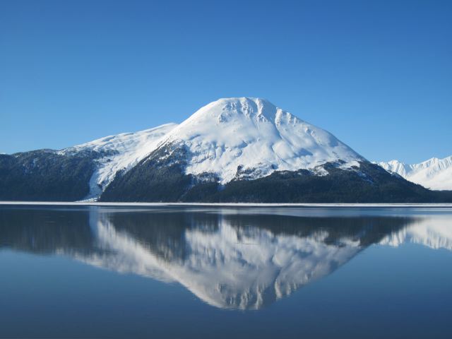
Drus North Couloir

Les Drus, The Drus. A beautiful granite monolith that stands proud above the Chamonix valley, burning like a flame as the sun sets down on it.

There is no easy way up the Drus. There is no easy approach to it either. It’s a mountain that you have to earn. I first climbed it back in 2001, upon graduating from law school. I was with my brother and we had wanted to climb the American Direct, a stunning line up the center of the west face. We had little experience and carried way too much with us – we had over 5liters of water for our bivouac half way up the face! – and we didn’t make it to the summit. The route doesn’t end at the summit, but with a mountain like the Drus, the top matters. I had always wanted to get back on the Drus. In 2003, I climbed the north faces of the Eiger, the Matterhorn and the Grandes Jorasses, all in just over three months. A week later, I was climbing the north face of the Piz Badile, another one of the six great north faces. I was hoping to climb all six in six months, but that summer had been very dry and the Drus was falling apart. An ascent of its north face would have been suicidal. I tried the north face of the Cima Grande too. We left after work on a Friday evening, drove 8hours to Cortina d’Ampezzo and tried to climb the route the following day. It was already late in the fall and very cold, but moreover, the local rescue team was conducting a training, rapping 300m down the face. Their ropes were hitting the face, triggering lots of rock falls. We had to bail and drive back to be on time for work the next day. I hadn’t given that project much thought until this summer.

With a very wet August in the Alps, I figured conditions were going to be amazing for early season ice climbing in the mountains. I didn’t have a precise idea as to what I wanted to climb. Adam was desperately looking for a partner to climb the north face of the Eiger but I had no real interest in climbing it again, I had been working non stop, guiding pretty long routes back to back and felt that I needed to rest more than go climb a big face. But since he couldn’t find anyone, I motivated to go with him and started to look forward to a bivouac on the face. Yet at the last minute, he found a partner. The next day, I woke up to intense FOMO desperately longing to do something big too. The weather was perfect, conditions were perfect and I was dealing with shuttling cars and house work instead of being in the mountains. During a failed attempt on the Lessueur route, I saw that the approach couloir to the Dru looked like it was in condition and I was excited to give it a go.

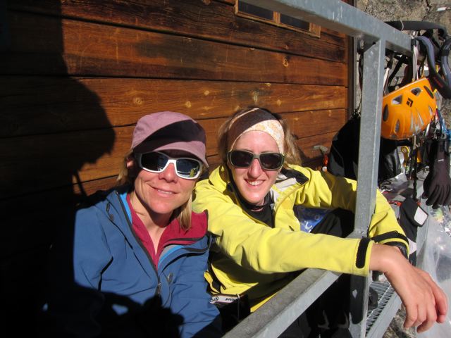
I first went with a girlfriend, Ildi Kiss, whom I hadn’t seen in a long time: we had first met competing in ice climbing world cups back in the early 2000. She hadn’t been in the mountains in a while but was motivated and it was really fun to reconnect with her and try this route with her. We left early in the morning and simul-climbed some of the approach couloir. Things spieced up after that. I led the first mixed section and she led the second one but ended up way left of where the route was.


So, we had to lower off and climb back up to the base of the Nominee crack – a 30m long overhanging crack filled with fixed pitons. We climbed it but when we got to the top, we realized it was a little late and that we would most likely get benighted on the route if we kept going. Night falls at 6.30pm at this time of year, so we only had a few hours of daylight left and I wasn’t keen to search for rappels in the dark (the rappel route doesn’t go down the climbing route). So we rapped but I knew I would be back before I flew back to the US, providing I found a motivated partner. I couldn’t pass up the perfect conditions on the route and the beautiful Indian Summer.

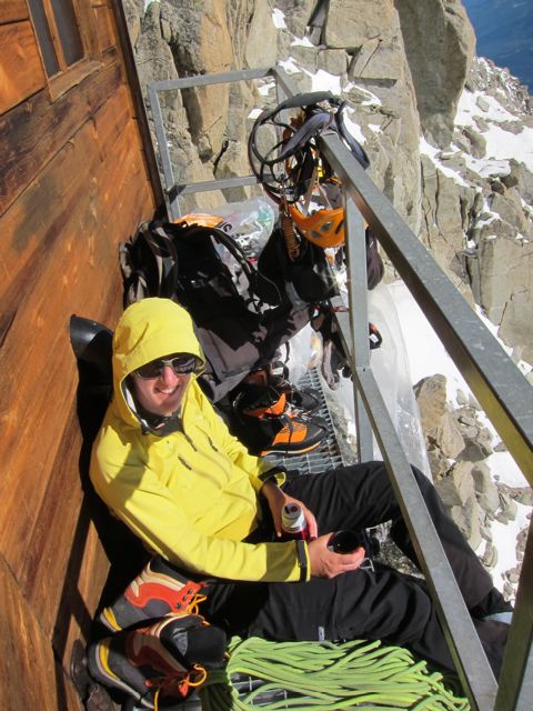
The crux indeed proved to be the lack of partners: people were either down south rock climbing, or working, or on expeditions and no one was really motivated to hike up there when you can access it more easily on skis in the winter. I guided the Midi-Plan traverse on the day following our return from the Drus. On the way back, I got a message from my friend Ueli Steck saying that he was really motivated to climb this route with me. I was bursting at the seams with excitement: not only I had a solid partner, but I also knew we would for sure make it to the top! My only worry was that I was worked from too many big days in the mountains and from lack of sleep, but motivation was all I really needed to get me up the climb. The body would follow.


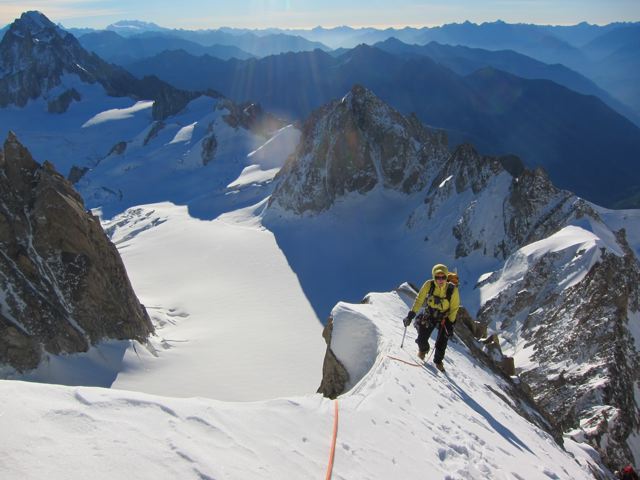
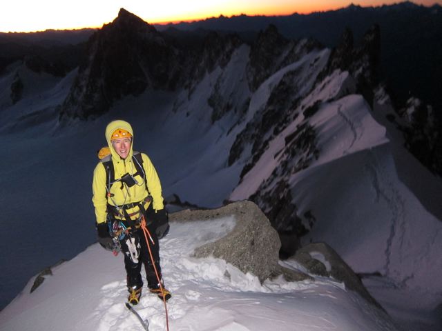
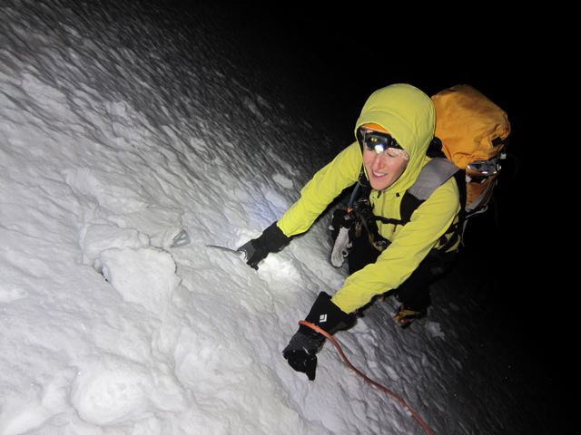
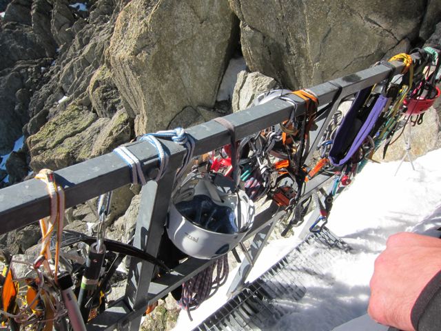
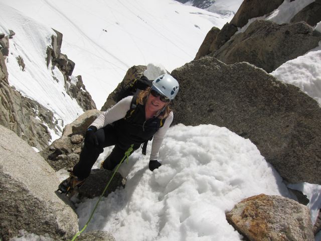
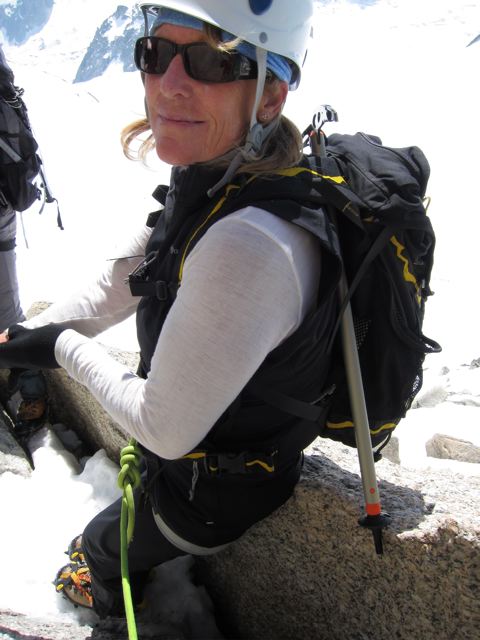
We met the following afternoon at the Montenvers train station to sort out gear. We hadn’t seen each other in a few years and it was fun to catch up as we hiked back up to the bivouac. We made good time hiking through the heinous talus field and reached the rocky knob at the base of the Drus in 2h30. We weren’t alone. Another party was going to climb the Lessueur route and two others were going for the same route as us. Since it’s an ice climb, we didn’t want to have anyone ahead of us, so we got up at 1am to start up the route.


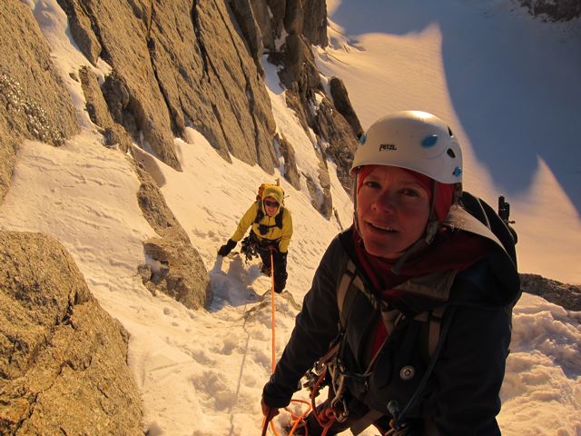
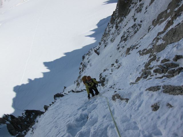
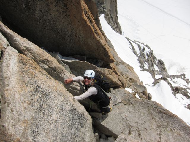
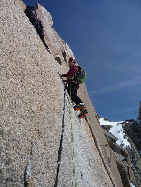
There was no moon, so it was pitch black out, but I knew the way and thought I could figure it out in the dark. Ueli led out and went off route pretty much right away, but it enabled us to climb a pretty fun pitch, so that was all good. We rapped down it and I led to the start of the difficulties. It was still dark when we got to the Nominee crack.


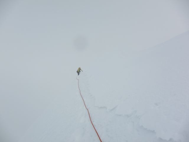
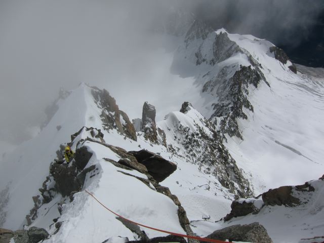
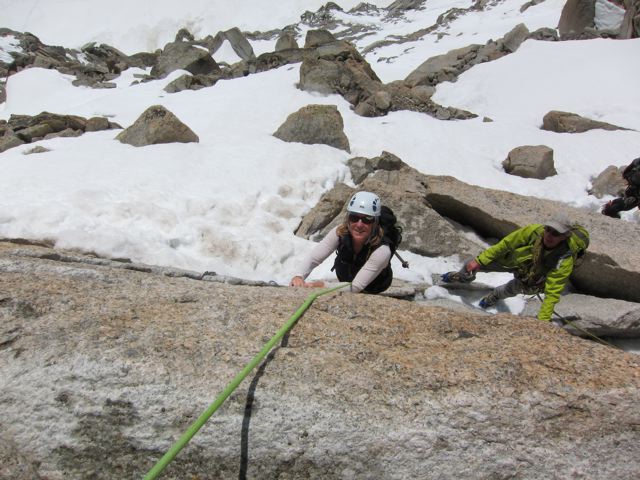
Ueli led it in style, freeing this very steep/slightly overhanging crack. I so wished I would have had monopoints to free it too, but with dual points, I couldn’t reach inside the crack and my feet would skit, so I resorted to stepping on some of the pins. Two more sustained traversing rock pitches with rotten ice and lots of wideness took us to the base of the ice couloir.


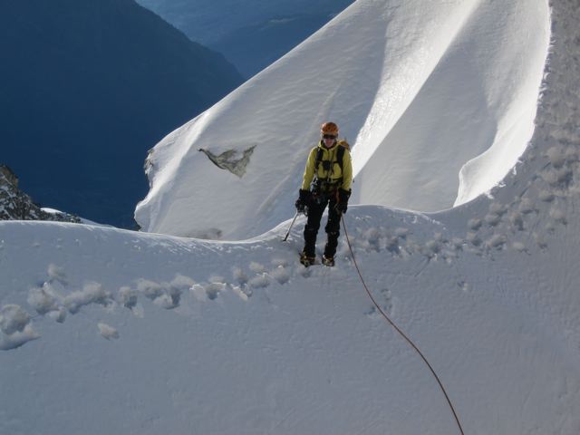
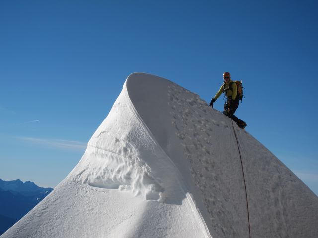
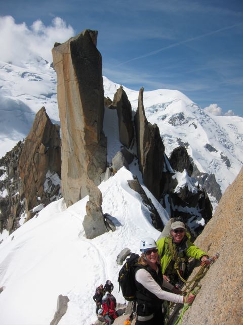
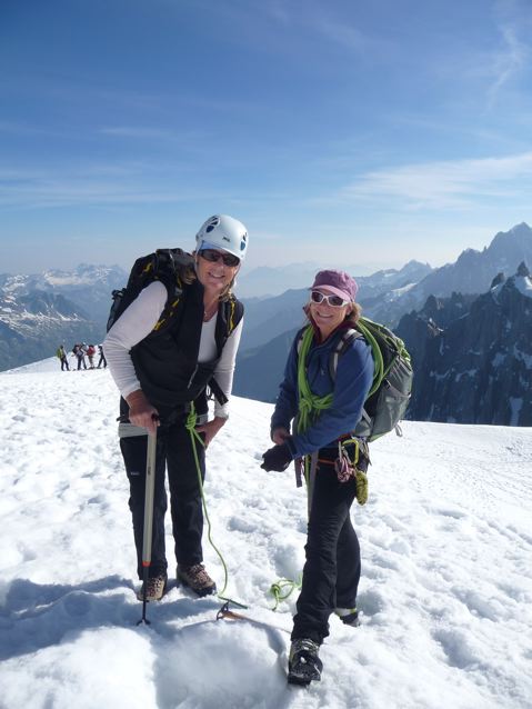
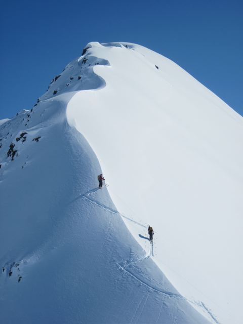
From there, we found perfect ice to the top. We simul-climbed it in two sections and made it to the Breche des Drus, embracing the sunshine. We kept going to the “antecime” of the Petit Dru, sorted out the gear and started back down to the Breche des Drus.

We had to build V-Threads (ice anchors) on the way down as there weren’t any, which made us think that we might have been the first to top out the route this season.

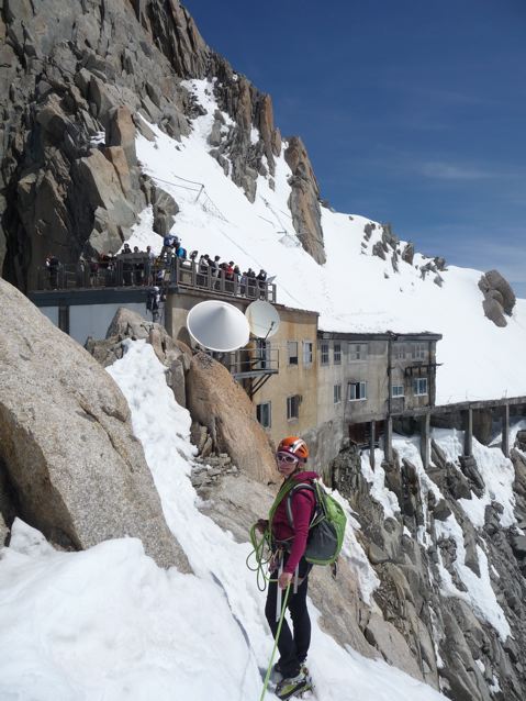
I lost count of the number of rappels we did down the 800m long face, but we were back at the bivouac by 3.15pm. After a little

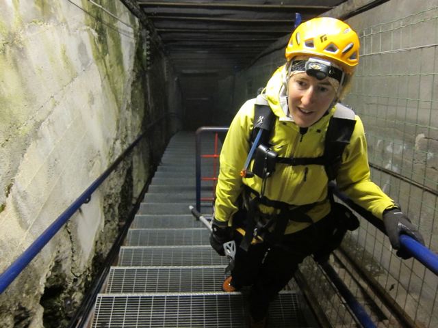
soup, we packed our stuff and made our way back down to Chamonix. The train had closed for the season, so we were forced to hike all the way down to the valley floor. We were down when the bells rung 7pm.
The north couloir of the Drus is the best climb I have done in a long time. It was sustained and varied, with lots of ice and mixed terrain. It’s one of those routes I could do over and over again! Of all the peaks in Chamonix, the Drus is the most striking and proud one. It’s every alpinist’s dream to tick this one off and I was all the more happy to reach the top by climbing this stunning line! It felt good to want a climb this badly again. I have spent the past couple of years focused on getting my IFMGA certification, almost forgetting about the lines that had haunted my dreams. Climbing the Drus has enabled me to reconnect to who I was before I decided to become a guide: an extremely motivated alpinist, climber and ice climber. I am already looking forward to the next big climb!

Kuffner Ridge
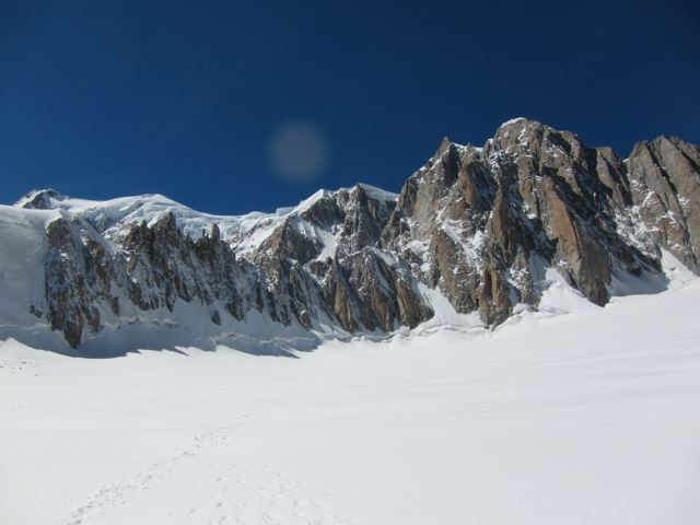
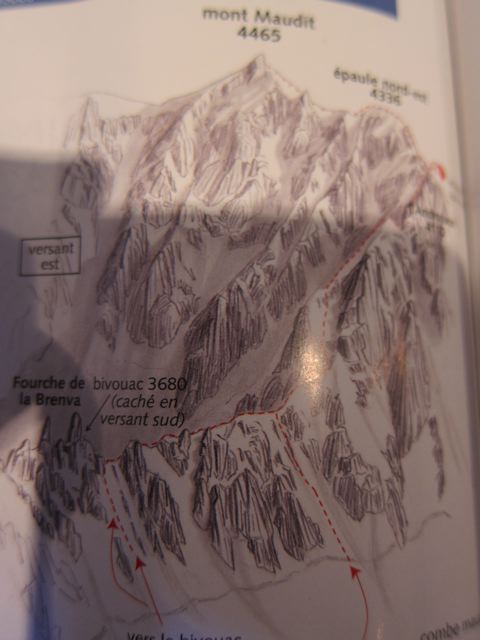
The Kuffner Ridge is border to Italy and France, separating two spectacular cirques: the Maudit Cirque and that of the Brenva (south side of Mont Blanc). The ridge was first climbed in the late 18s, by Mr.Kuffner who had to chop steps the whole way for his clients. Luckily for me, times – and gear – have changed!
The ridge is very long and offers spectacular knife-edge-snow ridge climbing and lots of mixed terrain. It tops out on Mont Maudit -Mont Blanc’s little brother – at 4465m in elevation. It’s one of my favorite climbs. I had climbed it a few years back with a friend and was excited when Flo asked me to guide her up it. I was looking forward to revisiting this noteworthy climb.
It took us two tries to get it. The first time, we left from the Aiguille du Midi et hiked past the majestic Grand Capucin to reach the bottom of the couloir leading to the Fourche Hut. This little bivouac is perched on the ridge, in a totally impossible location. It’s hard to understand how it can stand there on its own. It can only sleeps 12 people and there were way more people than that in the hut that night. Was it the nasty-ness of the hut, the crowd, the lack of sleep, the altitude? I don’t know. But 30mins into the climb, Flo got really super sick. She started throwing up and feeling very dizzy. So, we went back to the hut, napped for an hour and started the long descent down the couloir we had climbed. That took a while since we only had one 40m rope and the couloir is 200m long. When we got down, she felt better and we saved the day by climbing the beautiful Aiguille d’Entreves Traverse.
She went home that night. I called her again the following day and said that we should give it another go. She drove back from Switzerland and we rode the Helbronner lift across the Vallee Blanche and this time slept at the Torino Hut. This adds a few hours to the climb but offers way better sleep and food. We left in the pitch black night and headed to a couloir right of the regular couloir to meet the ridge a little higher up. We reached the ridge by dawn. It was a beautiful day, until I hear a huge serac fall on the south face of Mont Blanc, where Adam was climbing. The serac kept falling and falling. And then the heli came, in, and out, and in, and out. I thought for sure that Adam was dead. So the whole time, I was super freaked out, wondering how my life was going to be from now on. Eventually, I saw him way high up on the climb and was relieved! Horrible feeling though.
The climb was in great condition and we moved fast up the beautiful ridge that went on for ever. Gradually, the climb disappeared in the clouds. It had just snowed two nights before and the track down from the top of the Maudit had disappeared under lots of fresh snow and accumulations. We topped out in a full on white out and super strong northerly winds. I felt quite alone, having to navigate down the Maudit, breaking trail in sometimes thigh high snow. Yikes! Eventually, we found the three Mont Blanc track and made it back in time to catch the last cable car back down to Chamonix!
Thanks to Flo for wanting to do this climb and doing such a great job on it!

Rock Guiding in the Alps


I love all aspects of guiding. Alpine, ski, ice, etc. In the midst of a long season of guiding in the mountains however, rock guiding is a welcome breath of fresh air: light packs, approach shoes, climbing with a light rack, no crampons needed, often climbing in a tank top basking the sunshine… it really doesn’t get much better than this.
I was blessed with nearly two weeks of just that at a time when my body was screaming for a break from long alpine routes. Lucky me. On days when the weather is too bad to climb in Chamonix, I took my clients to sunny Italy to climb on the beautiful red dome of Machaby, where we climbed Bucce D’Arancia, a beautiful 10 pitch route with just enough breeze to make the sun enjoyable.


On warmer days, there are many options to climb around Chamonix, from cragging to long alpine rock climbing routes, either on red gneiss in the Aiguilles Rouges to beautiful orange granit. I guided a lot in the Aiguilles Rouges, which offers one of the most beautiful views on the Mont Blanc range.

I got to guide great routes right off of the Flegere:
The famous Index, Mani Puliti and Gaspard Ier with Tamsin:


Manhattan-Kaboul on Floria and La Ravanel on the Aiguille Crochues with Sophie and Denis:


There is amazing climbing right across the border too and we got to climb amazing featured limestone both on the Dent de Morcles and on the Sanetch with Evelyne and my friend Fiona.


Another climb in the Switzerland: The Pilier de la Pissechevre (the peeing goat!!)


I really enjoyed all my days rock guiding and was refreshed and ready to get back to the Alpine world after these two weeks on the rock. Next up was the Kuffner ridge… coming up in the next blog! Stay tuned!
The Bietschhorn

Once upon a time, the Bietschhorn was a 4000m peak. This mountain reigns proudly on the northern slopes of the Valais and is the only snowcapped mountain visible from anywhere in the Rhone Valley. Its the pride of the locals. So much so that on old maps, the Bietschhorn reached 4003m. This was thanks to a local Lotschental girl who seduced the geographer who had first measured this mountain into adjusting the elevation to a number greated than 4000m. When the correct altitude – 3934m – was finally put on the maps, the local wrote a threatening letter to the President of the Swiss Confederation, vouching that “The Bietschhorn was and would remain a 4000m peak!”
I first climbed this peak in 2005 during a Swiss Alpine Club training during which we climbed most of the routes one can access from the remote Baltschiederklause hut: The north ridge of the Bietschhorn, the south ridge of the Jaggihorn and the Arete Blanchet on the Lotschentaler Breithorn. I remember being blown away by this pristing remote valley, by the Chamonix like rock quality and last but not least, by the hut keeper’s yummy butter ladden cakes. I knew I would be back.
After the Meije traverse, I had hoped to take Flo on the Obergabelhorn-Zinalrothhorn traverse. Yet, recent storms had brought too much fresh snow at higher elevations. I suggested going into the Baltschieder Valley, which is at a lower elevation and south facing. She was excited to discover a new valley in her own backyard.
The hike to the hut first follows the Bisse de Undra. The southern slopes of the Bernese Alps drop so steeply into the V-shaped Rhone valley that they hardly ever see rain. The fields are therefore deprived of any humidity. As a result, the locals built and dug water runnels to get the water flowing from the glaciers all the way to the fields.


With 1850m of elevation gain, the hike to the Baltschiederklause hut is one of the longest hikes in the Bernese Alps. After the Bisse, the trail climbs to a little ghost village where we had a nice lunch before climbing steeply through fields and moraines to the hut. We arrived just in time to see the sun setting behing the following day’s climb -The Bietschhorn – and on the Mischabel range across the valley.


We woke up the following day to stars in the pitch dark sky. Following little dotted reflectors along the trail (Yup, that is Switzerland for ya!), we walked in the stilness of the night, with no one but us on the way. We reached the glacier by day break. We put crampons on and traversed the 2km long stretch of the Ausser Baltschieder glacier to the base of the North Ridge. After climbing up really poor rock and a 300m long snow/ice face, we reached the ridge proper: a snow and ice knife-edge ridge which leads to a more rocky ridge to the summit.


The view from the summit extends southward from the Monte Rosa to the Mont Blanc range and to the north to the Bernese Oberland (Eiger, Monch, Jungfrau). We climbed back down the way we came up and were back at the hut in the early afternoon, in time for a slice of straight-out-of-the-oven cake.


We woke up the following day to gray skies. We headed anyway, hoping that clouds would burn off as forecasted. The ascent starts litteraly five minutes from the hut and climbs up perfect granite. Half way up, we were caught by a snow storm and strong winds. By then, it would have been longer to go down than to keep going to the summit. The storm died a little and we reached the summit. A quick note in the summit book and we headed down, following cairns to the start of the 6x20m rappels back to the trail.


Again, we were back at the hut in the early afternoon, but we still had a long day ahead of us, having to hike back down to the car, 1850m below. We had a bite to eat and made our way down, marvelling at the surrounding summits and already dreaming of other climbs to guide in the area: The Arete Blanchet on the Lotschentaler Breithorn and the south ridge of the Stockhorn.


Cosmiques with Mom
I like to think that climbing is in my genes because my parents were climbers. We travelled the world to climb. And it’s still with great pleasure that I go climbing with them. My mother, Martine, is always excited to go on an adventure. At 65 though, her knees are giving her much trouble. So, I try to pick climbs which don’t involve much approach or descent.
This year, we headed to the Cosmiques Ridge on the Aiguille du Midi in Chamonix, France. After a frothy capuccino and still warm croissant in town, we rode the cable car nearly 10’000ft up to the top of the Aiguille du Midi. There, the view stretches out to Mont Blanc and onward to Italy. The Aiguille du Midi is also the gateway to the Vallee Blanche, a classic ski run in the winter, which ends 10’000ft later back in Chamonix.
Hiking out of an ice cave, we made our way down the knife edge snow ridge which drops steeply down 3500ft to the north, and down to the col du midi on the other side. You don’t want to fall down on either side there. The terrain eases up passed the ridge. We contoured the base of the striking south face of Aiguille du Midi, which rises like a bright orange flame out of the glacier below and kept heading west to the start of the ridge proper.
Although I had already done this climb with my mom, she was thrilled and excited, blown away by the beauty of the scenery around, as though she was there for the first time. It felt so special to be here with her. We climbed up mixed terrain, some time on snow, some time on the reputable Chamonix granite. This ridge is climbed and guided so often that locals have drilled holes in the rock to make it easier to climb with crampons. Only in the Alps could you see that! We traversed a snow couloir, contoured gendarmes – one of them has the highest 5.13 crack in the world: Digital Crack – and made it to the crux of the route, a diagonal slanting crack up a used-to-be blank-now-drilled-all-over-wall. This section is always a bottleneck, with people struggling up the 10m high crux. We killed time rehydrating, soaking in the view and enjoying each other’s company until it was our time to climb. My mom made quick work of the section and we climbed on, traversing into the north side of the ridge before reaching the summit, where a crowd of people coming out of the cable car was snapping picture after picture of us.
My parents opened my eyes to climbing and taking my mom on climbs now is not only a way for me to give back, it’s also very rewarding to take such an accomplished climber with me. My mom has pushed the boundaries of woman climbing in her own way when she was younger. She climbed great classic such as the Gervasutti Pillar, the Aiguille Noire de Peuterey, did the first female ascent of the Naranjo de Bulnes in Spain, climbed in Peru, came first in many ski mountaineering competition. She is a true model for me and I am greatful to be able to share time with her in the mountains.


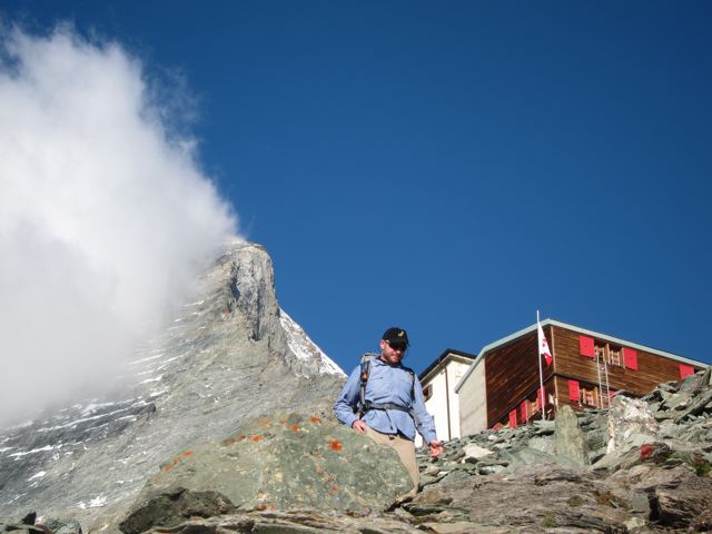
Matterhorn
The Matterhorn is certainly the most iconic mountain in the world. No less. It’s no surprise that everyone wants to stand on its summit. Yet climbing the Matterhorn is no walk in the park. It requires fast climbing and a great sense for route finding.
When Whymper first climbed it in 1864, they started from Zermatt and made it 3/4 of the way up in a day, which is mindblowing considering the times, the gear they had and the very poor rock quality on the climb. When I first attempted the Matterhorn, Iwas 17. My brother had decided to climb it in pure style, starting from Zermatt instead of taking the lift to Schwarzsee. I had no experience back then and it was late in the Fall. We made slow progress and turned around. The next time I visited the Matterhorn was in the winter of 2003 to climb its great north face – one of the three great north faces in the Alps. We left the hut at noon because of poor weather. We had a twelve hour window of better weather and decided to go for it. We bivouacked below the summit, sitting on a ledge so tiny that each time I fell asleep, I also fell off my ledge. We also lost our lighter and couldn’t make any water or warm food. It was a little epic. Since then, I have stood on the mighty Matterhorn many times. On this guided trip, I was working with a local Swiss guide, Jean Pavillard and American Steve Banks. Our clients were a brother and sister, Alicia and Peter, from Australia and their friend, Patrick. They had been climbing around Zermatt for a few days, training to get ready for the D-Day. The whole Matterhorn experience is pretty particular.
The local Zermatt guides own the show. On the walls in the hut is written: breakfast 4am, departure 4.20 (underlined indeed). There are so many stories around the Zermatt guides. They have been known to: lock the hut door so that no one would leave before them, send a guide ahead in the wrong direction with a headlamp on while the rest of them went on without lights, just as to lead the other parties astray, be really hard on their clients, etc. Granted, they know the route by heart and are super fast and efficient at climbing it. Yet, there is no need for such attitude. Clients are tied into the rope while still chewing on their morning breakfast slice of bread, with their helmets and harnesses already on. People are all racing for the door, hoping to be the first ones (after the Zermatt guides) to be out the door and race to the start of the climb, 5 mins out the door. There, you wait for your turn to climb up the fixed ropes initiating the climb. It’s not exactly your best wilderness experience, but it’s pretty unique in its own way.
It’s a long ways to the summit: 1200m long to be precise. You need to keep a pretty steady pace the whole way, as it gets harder the higher you go. After the Solvay Hut, the terrain is more exposed, harder to protect in places, and then you get to climb up fixed ropes and neve all the way to the summit.
Although we didn’t summit this time, it was great to be back on that mountain! Looking forward to next time.


Arete des Papillons (Papillons Ridge)

The Papillons Rige is a great climb on beautful rock on the Aiguille du Peigne in Chamonix. You reach the base within a 30-45min hike from the Plan de l’Aiguille – the Aiguille du Midi mid station.
Sophie is a doctor in Geneva and the mother of two little children, so she was excited to do a day climb. Last year, we did the Cosmiques Ridge together and the Papillons Ridge seemed like the natural progression. We were in the shade the whole time, which was perfect given that it’s in the 30’s in Chamonix (90F). This ridge offers just the right amount of technical climbing and an amazing view on the north face of the Aiguille du Midi and the Aiguilles Rouges across the valley.


A great day climbing in Chamonix! Merci Sophie!
Its Majesty: La Meije
Ah, La Meije!
La Meije was one of the last great peaks of the Alps to be climbed and the first to be climbed only by French people. Prior to that, English men would hire guides to take them up peaks like the Matterhorn, the Aiguille Verte, etc. So it was with great pride that 19 year old Emmanuel Boileau de Castelnau summitted with Pierre Gaspard and son on August 16, 1877. Before then, many had tried and believed it would centuaries before the peak would be climbed. Each section of the climb has a name, often related to how far the previous climber had climbed. The Pyramide Duhamel was a kairn built by Mr. Duhamel himself, to show how far he had gone. During the first ascent, the crux sections were climbing in….. SOCKS! It was many years before the peak saw a second ascent. The Meije – which in local slang means “the south” because the sun goes over it at noon” – is still to day one of the most beautiful ascents in the Alps!
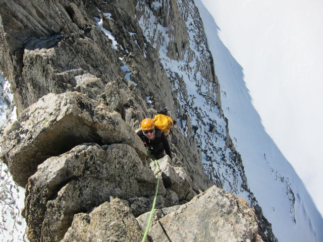
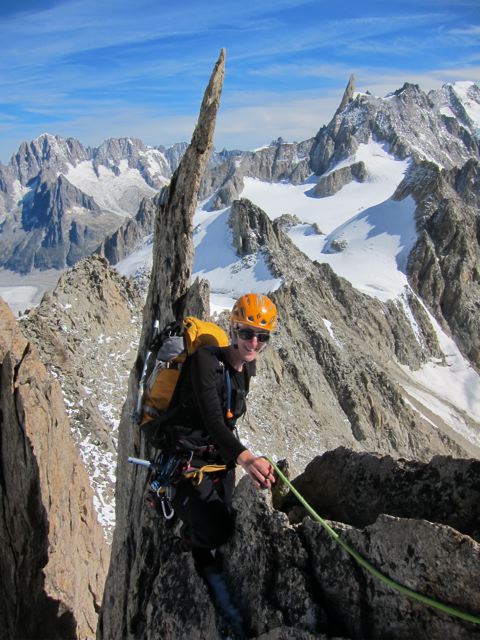
The weather wasn’t looking good in Chamonix or in Switzerland, so I suggested to my friend/client Floriane to drive south where the sun is (almost) always shining. I had done the climb in 2002, but hadn’t been back to this area since, and I was as excited to guide it as I had been when I first did it. We left from the ski mecca La Grave and climbed the Enfetchores to the Breche de la Meije and down to the Promontoire Hut. The climb follows a 900m long spur/arete to the top of the Grand Pic (3983m… the highest of the Meije traverse peaks), followed by 3x50m rappels into the Breche Zigmondy. It then contours the Dent Zigmondy by traversing into the north face and climbing up cables to a notch, and continues up and down the 2, 3, 4th tooth all the way to the Doigt de Dieu – aka God’s finger. How I love the names in the Oisans – Southern Alps region! Three rappels takes you down on the glacier. From there, the tiny, tiny, tiny but ever so welcoming Aigle Hut is only 30mins away. Day three, we climbed the last summit of the Meije – The Meije Orientale – and then hiked down (loooooong ways down) to Villard d’Arene, and hitched hiked down to La Grave. It snowed overnight and we climbed the Rateau the last day in full on wintery conditions. Here is a photo album to illustrate Flo and I’s four days in the Ecrins Range.


I am taking Floriane into another amazing place this coming WE. Check back for more adventures to come!
Technical Alpine Climbing Week
My first guided trip in the Alps this summer was working for ISM – The International School of Mountaineering – based out of my home town Leysin in Switzerland. My Dad had worked from them back in the ’70s and I grew up surrounded by the guides who worked there and was mesmerized by them. It’s probably then that my secret desire of becoming of guide budded. And hence ISM seemed like one of the obvious companies I wanted to work with.

I would be working with Adrian Nelhams, as I had the previous year. Adrian is British, has a little son named Monty and is an examiner for the British Guides. I really enjoy working with him.
We met the day before the start of the course in Leysin to discuss the plan. We decided to climb the SW ridge of the Grand Cornier in the Valais and the west ridge of the Dent de Tsalion in Arolla, along with the nearby Aiguille de la Tsa.

We hiked from Ferpecle up a rugged trail and then glacier to the Dent Blanche Bivouac. It was raining and snow conditions were completely isothermic, which made for difficult travel. But the beautiful little rounded shaped bivouac made it all worth it. After a night of heavy rain, we woke up to perfect blue bird skies and great views of the mighty Dent Blanche north face and of our climb, the SW ridge of the Grand Cornier.


At 3962m, The Grand Cornier is just shy of 4000m, but its surrounding giants have nothing on him. There is no easy way up or down it and the SW ridge offers amazing climbing up its sometime snowy or rocky but always knife edge arete. With the previous night’s rain, the snow was very punchy all the way up the climb, which made for strenous trailbreaking.


After many hours of breaking trail and climbing up the amazing SW ridge, we climbed down the normal route, which is just as hard and long. There were lots of precipitation in June and the snowpack hadn’t yet fully transformed, which made for hainous postholing down to the Moiry Hut, where we spent the night. The Moiry hut was just remodeled this year, so we got to enjoy this beautiful new facility! The following day, we hiked down from the hut and drove back to the Arolla valley.


Day 4, we climbed a technical via ferrata right above the little pittoresque town Evolene. It was very steep to overhanging in many sections, which got some of the client’s hearts going!

That afternoon, he hiked to the beautiful Tsa Hut above Arolla, to climb the west ridge of the Dent de Tsalion and the Aigille de la Tsa.

We woke up in the early morning to hike up a boulder field to the base of the climb. The few first pitches instantly wake you up, climbing up steep and beautiful rock. The whole 600m. of ridge climbing is up perfect cracks and nice ridge features. A nice and long journey.

From the summit, we scrambled down to the glacier and joined the start of the Aiguille de la Tsa, a striking mini Matterhorn like peak.


We then hiked up and over to the Bertol hut. The view from the Bertol Hut stretches to the Dent Blanche, the Tete Blanche and the Bouquetins to the south and over to the Pigne d’Arolla and the Aiguille Rouges d’Arolla to the north. Although this is a great hut, the toilets are the biggest shame. I thought I was going to pass out from the smell.

This was another great week with the International School of Mountaineering.
Mont Blanc

It’s 7.30am when we reach the summit of Mont Blanc. At 4810m (15,782ft), Mont Blanc is the highest peak in western Europe and in the Alps, which means that right now, it feels like we are standing on top of the world, higher than any other peak that the eye can see. It’s quite a show! Standing on the knife edge snow ridge, we have one foot in Italy and one foot in France. Chamonix, to the north, is still in the shadow of its surrounding giants, while Courmayeur, to the south is already in the sun. We bask in the morning sun, enjoying the fruits of our effort, catching our breath and already looking on to future possible ascents: the Gran Paradiso -highest peak in Italy – to the south, the Matterhorn and Monte Rosa to the east, the Eiger to the north.
The climb started when the three of us guides – Tomaz from Slovenia, Daniel from Switzerland and myself – met the six clients the previous day at the Bellevue cable car in Les Houches, a few kilometers down valley from the alpine climbing mecca, Chamonix. We rode the lift to then catch a little mountain train to the start of the trailhead at the so-called “Nid d’Aigle”. We hiked from there up steep switch backs and a rocky spur to the Tete Rousse Hut at 3167m. The Tete Rousse hut is a beautiful and comfortable little hut perched high above the Vallee de l’Arve, with the north face of the Aiguille de Bionnassay and the strenuous Gouter Ridge looming above. The great thing about climbing in the Alps is that you don’t need to carry any camping or cooking gear with you. The hut system is so well done, that all you need is your climbing gear and warm clothing. The huts are equipped with beds and comforters and the hut keepers cook delicious pies to snack on before or after the climb – it was a real challenge for me to pick between the blueberry and the walnut pie!!! – and all-you-can eat meals, with soup, cheese, main course and dessert.


At 1am, we woke up, had breakfast and headed out in the moonless night up the 700m long rock ridge to the Gouter Hut. We encountered one of the cruxes of the route 20minutes into the climb, when crossing the infamous “Grand Couloir”, a 50m wide couloir which sees tons of rock falls and that you need to run across. After that, we scrambled up easy but exposed rocky terrain to the Gouter Hut, which sits on the Aiguille du Gouter at 3817m. Lots of people stay there to climb Mont Blanc, but it’s got a bad a reputation for being extremely crowded and dirty, with people sleeping on tables and rats running around. A new hut is getting built and should be ready to host the hordes of people that climb Mont Blanc by 2012. From the Gouter hut,we follow an almost horizontal ridge toward the Dome Du Gouter (4237m), and onward to the Vallot Hut (4362m)

– a trashed observatory that people go in to find warmth on cold windy days or when waiting out bad weather. From there, we climb steeply up the sometime knife edge west ridge called the Arete des Bosses – The Bumps Ridge -, going over the Grand Bosse (4513m) – The Big Bump – and the Petite Bosse (4547m) – The Little Bump – and along the narrowing ridge to the top of Europe.
My clients today are Josi and Stuart from the UK

. They were fit and we made it to the summit in good time. There is no wind on the summit and it’s a bluebird day with warm temperatures. We snack, rest and my mind drifts to how it must have felt to be the first people – Jacques Balmat and Michel Paccard – to summit Mont Blanc back in 1786. People had tried to summit Mont Blanc long before that time, but the main concern was how to get up and down in just one day since the local peasants did not believe that one could survive a night in the open, in the snow, a reference to the old superstition dating from the time when the range was known as the Montagnes Maudites – The Accursed Mountains. When a man, Jacques Balmat, got lost on the mountain, was benighted and came back to tell the tale, he was living disproof of the legend. It would now be possible to climb Mont Blanc in more than a day and Jacques Balmat proved it by summitting on June 8th, 1786. Over 200 years later, Mont Blanc is ascended by an average of 20,000people.

This is my fifth ascent of the peak. I have climbed it through different routes: from France over the Arete des Bosses, the Three Monts Traverse and the Grand Mulets, and from Italy by climbing the Freney Pillar, one of the hardest routes in the Mont Blanc range and one of my greatest climb ever! I always look forward to climbing this beautiful and prestigious peak, for myself or with clients.
Caroline George with www.intothemountains.com
Guiding on Rainier
Early June, Adam and I left the comfort of our Salt Lake City home to work on mighty Rainier, a 14,411ft (4,392.5m) high volcano in Washington State, for Rainier Mountain Guides (www.rmiguides.com).

We drove 15hours straight to Ashford, where RMI and its facilities are located. Lodging is provided for the guides and we share two areas: The “upscale” Ranch, and the “Farm”. It was super fun to stay with the great community of guides who work at RMI, cooking dinners or going out to dinner together.
Adam and I worked the Four Day Summit Climb (http://www.rmiguides.com/rainier/?id=3&program=4-Day-Summit-Climb), which climbs the classic Ingraham Direct route at this time of year, and later in the seaon, the Disappointment Cleaver. For the Four Day Summit Climb, we start the program with an orientation, which includes a gear check, talking about Mount Rainier’s history, conditions on the route, how the climb will unfold and what he expect of the clients.
The following day, we meet the clients at the RMI Basecamp after the daily guides meeting. We drive up to Paradise and hike to find snow to do the snow school. Right now, there is so much snow left at Paradise, that we can get on snow right away. We teach clients skills that will help them summit Rainier with a guide. This includes how to walk efficiently and safely on snow, with and without crampons, how to use an ice axe, how to self arrest, how to travel with a rope properly and how to be be efficient during breaks on the mountains. We also teach them Leave No Trace principles to keep the mountain as clean as possible and preserve the mountain as it is for future generations.

Jesse in self-arrest position
Unfortunately, there was a lot of moisture in the NW while we worked on Rainier. The weather forecast never looked great and we often had to do the snow school in the rain, or hike to Muir in the rain.

Adam and Tim in the rain on the way to Muir

The Butler House, where guides eat and sleep, and boil water for the clients.

View from the Butler House on the Gambu, where the clients sleep. On the left is the ranger’s living quarters.
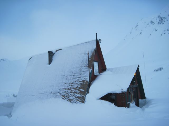
The Gambu sleeps 18 clients. It’s a pretty old building that was built for temporary use a long time ago and was never taken down, so we still use it. Clients only spend a few hours in there, since we get up around midnight to climb Mount Rainier.

Inside the Gambu
Depending on the weather, we wake up clients anywhere from 11pm to 2am or even later. If the sky is clear and conditions on the mountain are good, we get up very early. We leave camp with helmet and headlamps on, crampons and harness on and ice axe in hand.

We start our climb by headlamp and walk for about an hour in the dark, crossing the Cathedral Gap and making our way to our first stop: the Ingraham Flats. This is where other guide services have their high camp. So this is a “safe” place. But this is also how far the cloud from the June 6th avalanche came down!

Ingraham Flats with sunrise on Little Tahoma

Crevasses below Cathedral Gap
On our first trip, conditions on the mountains weren’t very good. It had been snowing for a few days at Camp Muir and the wind had been howling at upper elevation. That, together with cold temperatures, made the perfect combination for an avalanche to occur. We hiked to the Ingraham Flats and had decided that we would go no further. We broke the news to our clients and explained why we were going to turn around. There were 11 people ahead of us, so it was hard for clients to understand why we wouldn’t keep going. Sometimes you wish that there would be a small benign avalanche in the distance to prove your point. We were about to dig a pit for clients to understand how the snowpack works. But as we looked up, a massive avalanche was coming down toward us. We definitely thought that it was headed for us, so we will started running. The snow was so deep though that we were not going anywhere in a hurry. So, we hunkered down expecting to get hit. But like a fist turned into a caress, we were merely sprinkled by the cloud. Adam was a little higher up than me and he saw a glove sticking out of the snow. The 11 people ahead of us had all been caught in the 300mx1200m avalanche. Adam and a few other guides (Tyler Jones and Mark Falender) dug out two more Koreans. One of them was blue already, wasn’t breathing and was unresponsive. I organized for clients to go down with another guide, Tom, so they could be out of avalanche hazard and then went up to watch over the rest of the crew to make sure no other avalanche was coming down on them.
1 person is still missing in action, and all the others survived.

Sun rising on the Ingraham Direct, after the avalanche
Recently, Adam and I decided to get a van to travel in. I guess, as you get older, comfort becomes more and more valuable, espacially when you spend so much time on the road. Sleeping in a tent gets a little old. We randomly found this super cheap VW van. I think the guy didn’t realize what he was selling, which we were happy about. I grew up travelling with my parents in these kinds of up-pop vans and loved it. I am so excited to experience that again.


The Honeycomb at Tieton 
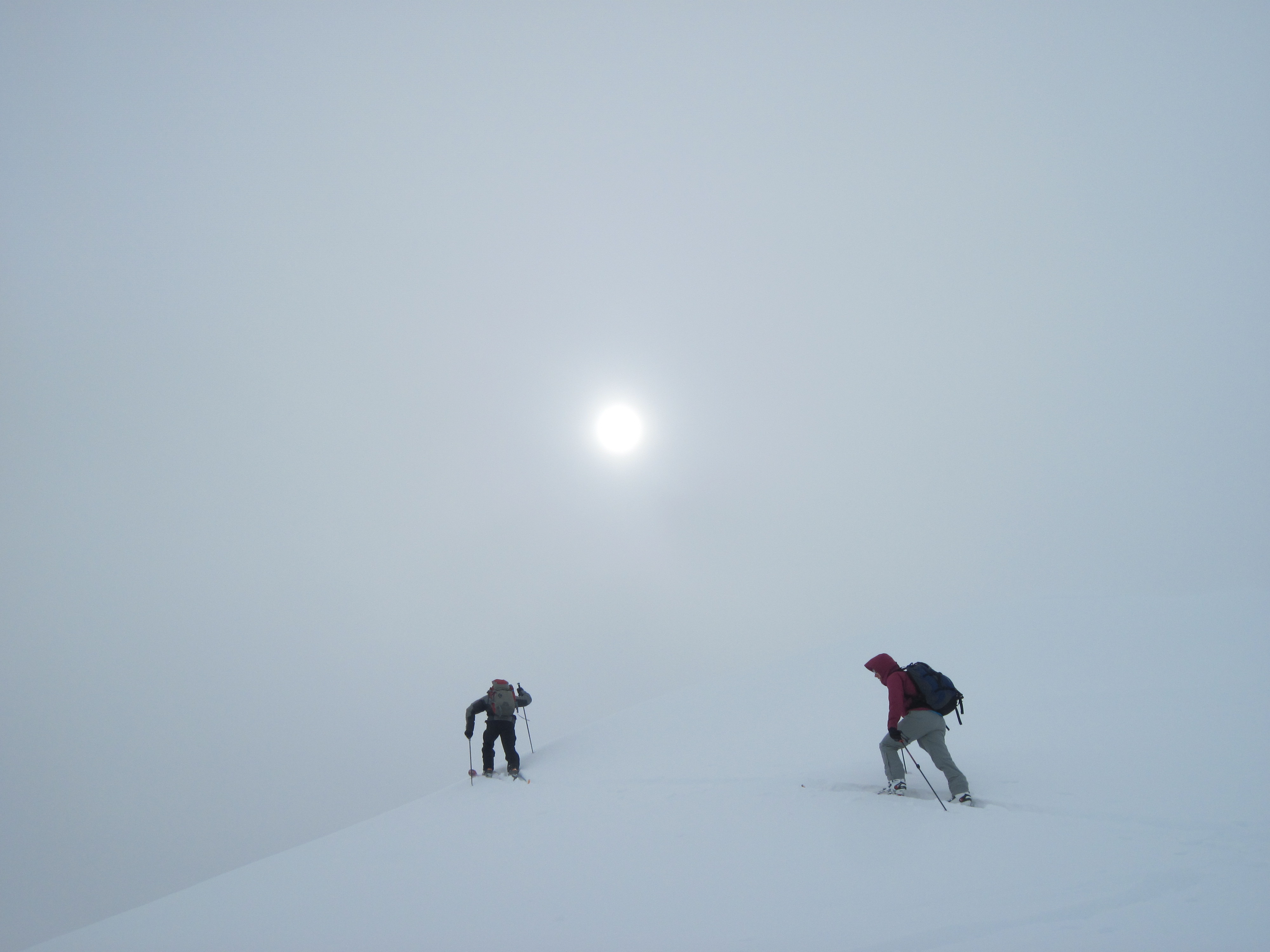
Adam getting some laps in at Lava Point, Tieton During my stay, we tried Rainier three times. The first time, we got shut down my the avalanche. The second time, conditions were still too unstable on the mountain. But, as the saying goes, third time is the charm. We woke up to nice weather and decided to climb. We woke the clients up at midnight and headed out. By the time we hit the second rest break at the top of the Disappointment Cleaver, we were in a complete white out. But with a good track, reasonable temperature and little to no precip, we made it to the summit by 7.30am. It was nice to end the seaon up there with a summit of Mount Rainier!
Adam and I are spending the rest of the summer guiding in Europe. Stay tuned!

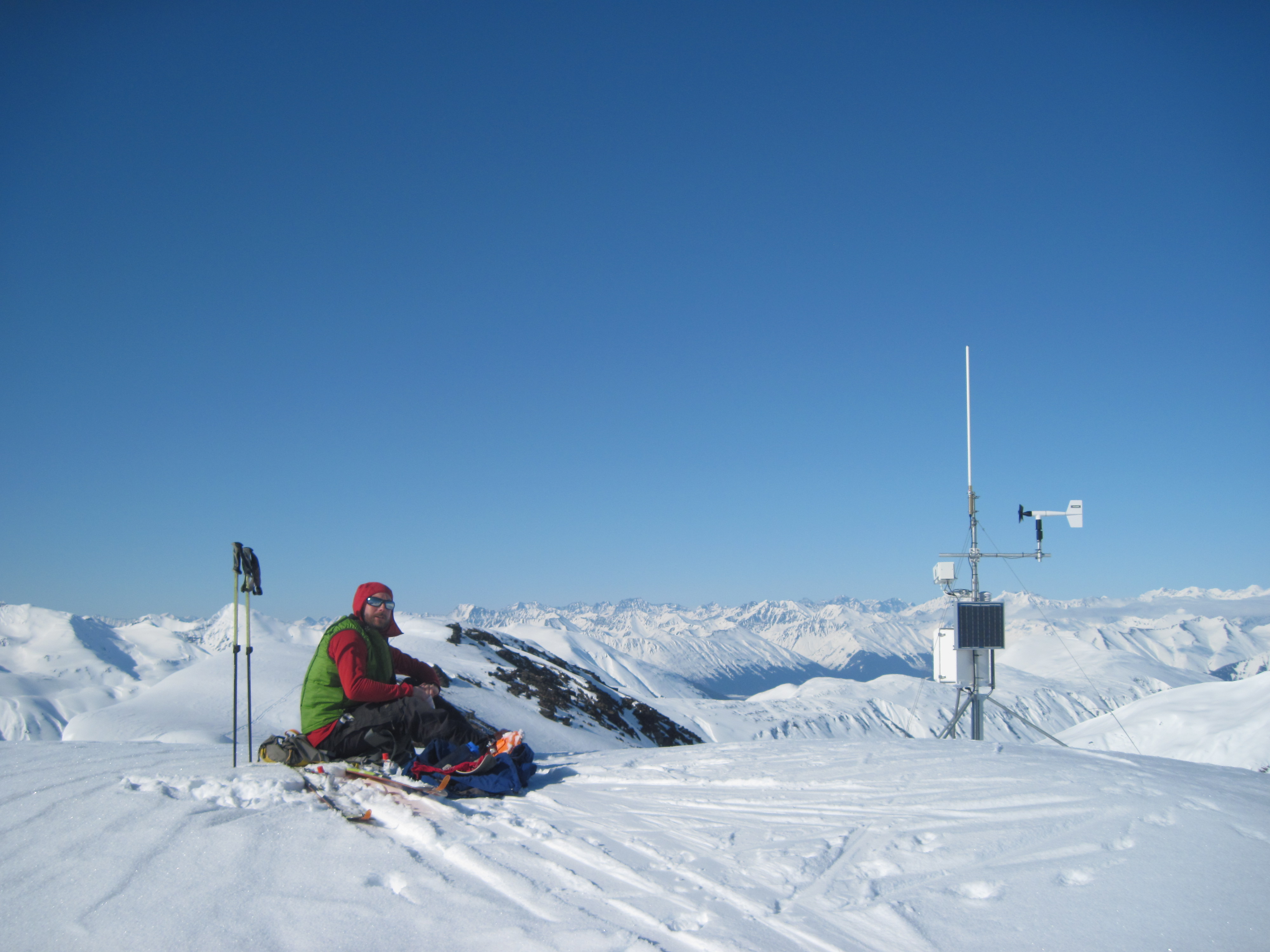
Guide Miles Clark psyched to be on the summit, despite winds, snow and no visibility 


IFMGA
Becoming a full IFMGA (see footnote) certified guide has been my lifelong dream. A few years back, I took a friend up the beautiful Forbes Arete on the Aiguille du Chardonnet in Chamonix. She had never climbed any mountain and I was in charge of the whole climb. I loved how taking someone up and down a mountain required so much problem solving: what time do we need to start, how do we get to the base, what are the hazards and how do I manage them, how much rope should be out on the glacier, on a steep snow section, on a rocky rid


ge, what should I use for protection, where does the route go, what is the most efficient yet safe way to do this section, how do I care for my friend, etc. Each climb is a different puzzle with different solutions. I loved that about the mountains. Sitting on the summit, basking in the sunshine and in the joy of having accomplished what I had set to climb, I thought: ” And guides get paid to do this. That’s what I want to do with my life”.
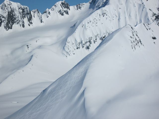
One of the perks of the AMGA/IFMGA certification process is how much you get to travel to train and take courses and exams. I love being on the road, so this suited my lifestyle perfectly. Over the past two years, I have learned, refined and applied many skills: terrain assessment, recognition of hazards and risk management, navigation, proper use of terrain and gear for protection, route finding, client care, rope tricks and rope management, snowpack assessment, weather patterns, guiding ethics, waste disposal and many more tricks of the trade. I have climbed more routes in Red Rocks than I could ever have hoped to climb there and have grown very fond of the contrast between the wilderness in Red Rocks and the craziness in close-by Vegas. I have also had to adapt to the pure style of climbing that you seldom find in Europe: chimneys weren’t my forte and climbing the likes of the ultra classic Epinephrine was a nemesis that I learned to embrace. Through the Alpine process in the Cascades, I have also discovered what it means to really be self-sufficient in the mountains. Carrying my “home” on my back and learning how to build rescue shelters has been one of the most constructive tools I have taken away from this process. Because truth be told, if something happens in the mountains, you are going to need to be able to figure it out on your own. The ski process has provided me with great insight on how to assess different snowpacks. We skied in the Chugach and the Talkeetna mountains, covering terrain from Valdez to Girdwood/Turnagain Pass to Hatcher Pass – ski mountaineering, heli skiing and doing multi-day overnight trips on massive glaciers.
But it’s not all fun and games either. Getting a certification means that someone is assessing you and that can be destabilizing. It’s hard to have someone look over your shoulder constantly. Most examiners do a great job of pretending that it’s just a regular day out and you’re just doing your job guiding. Yet, when you’re in the lead, a million thoughts go through your mind and you are constantly second guessing yourself, wondering if you’re doing what you think the examiner wants you to do. Throughout the training, all candidates take turns being in the lead and playing clients. This was a personal challenge as I found it hard to consider my peers as my clients, telling them what to do and how to climb or ski when you know that they know what they are doing and don’t need your guidance. Some of the courses last up to 12 days and you have be on your game throughout the whole time: you wake up early, meet early, go for big days in the alpine, on rock or skiing, get fried by the sun or worked by the wind and cold temperatures, get back to an hour long debrief with the candidates and with that day’s examiner (you are seen by different examiners), plan for the next day, pack your bag, cook a meal and repeat the following day. I find dealing with stress always harder to manage when I am tired.
I am often asked if the process is harder for women. There aren’t many women with this certification throughout the world. There are a little over 50 women in the world currently, with only 7 in the USA. During this last exam, Angela Hawse and myself became the 6th and 7th women to achieve this status in the USA. Obviously, the profession is very male dominated. But there are definitely some advantages to that. I never felt like being a woman made the process any harder or that my examiners judged me on that. Since I am smaller, they would righteously sometimes point out that with two clients on my rope, I needed to add more security at times, because of the weight ratio. I think it’s important to acknowledge the differences between men and women and guide accordingly.
This April, I flew to Alaska to take my final exam: the Ski Guide Exam. Prior to the exam, all the candidates went and explored the areas that we thought we might ski on our exam. Snow conditions were pretty bad since it rained very high up and Hatcher Pass – one of our destination – only had 50% of its normal snowpack. The exam was challenging in that we encountered difficult skiing conditions (thick breakable crust), white out navigation, rain, etc. Overall, I felt pretty good about my exam, but you never know for sure. It’s scary to get so close to your dreams. As a new rule, the AMGA no longer gives out results on the last day of the course or exam. Candidates have to wait two weeks to get their results online. Each day though, I checked to see if my status had been updated. But always read : “Not Submitted Yet”. Every time I clicked, my heart would start pounding, only to slow right back down. On the D day, I looked so many times, that the AMGA page must have gotten the most hits it’s ever had in a day! At 6pm, I clicked again, and there it was: “Passed”. And that’s all it took – 6 letters – for my lifelong dream to come true: “Passed”. With this last exam, I completed my full IFMGA certification. The certification process has been the most rewarding achievement of my life Yet, although this an end in itself, it really is only the beginning to my career. And now more than ever, I should remind myself of this adage: “Guide, the mountain doesn’t know that you are a guide!”
The American Mountain Guides Association (www.amga.com) is a member of the IFMGA (International Federation of Mountain Guides Association: (http://www.ivbv.info/en/), which is international governing body responsible for guiding standards and education around the world. The AMGA provides each year training in alpine, rock and ski. Being IFMGA certified means that you have taken and passed a series of courses and exams and are certified in all three disciplines. In most countries, this certification is required to guided legally.


