Midnight sun rock climbing in Lofoten, Norway
Midnight sun rock climbing in Lofoten, Norway
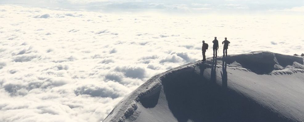
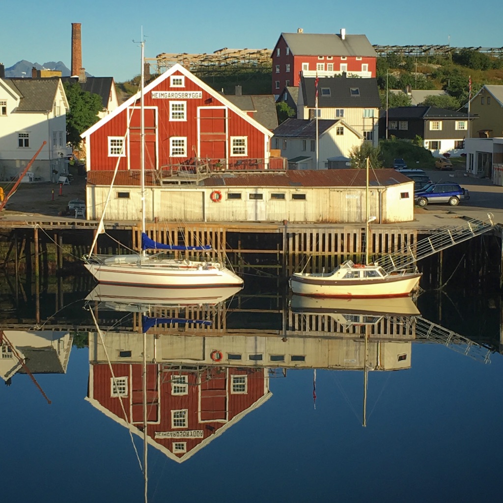
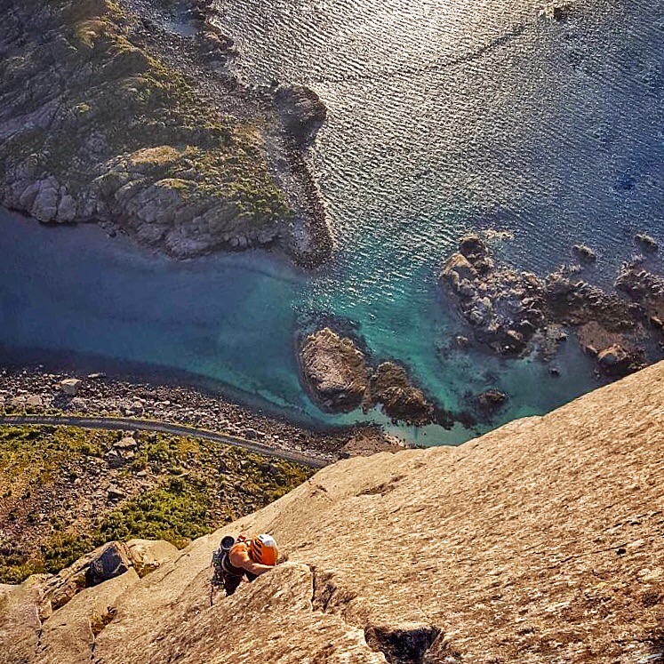
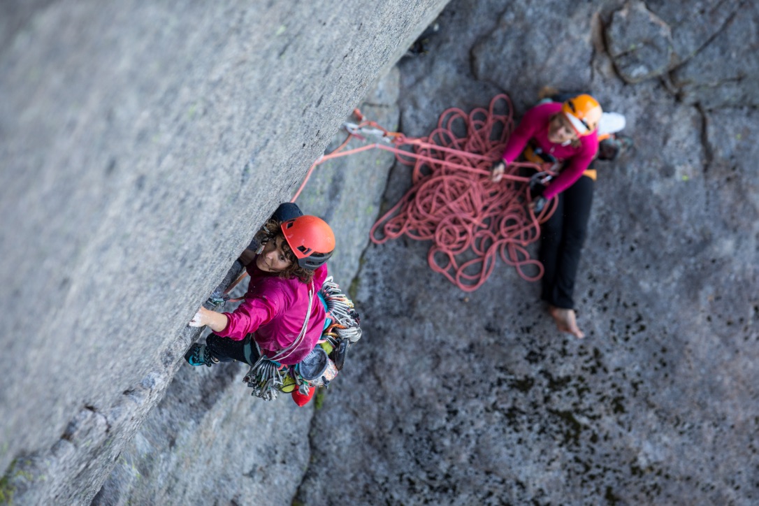
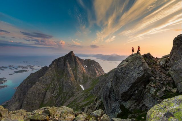
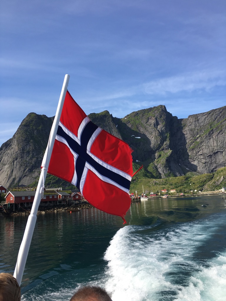
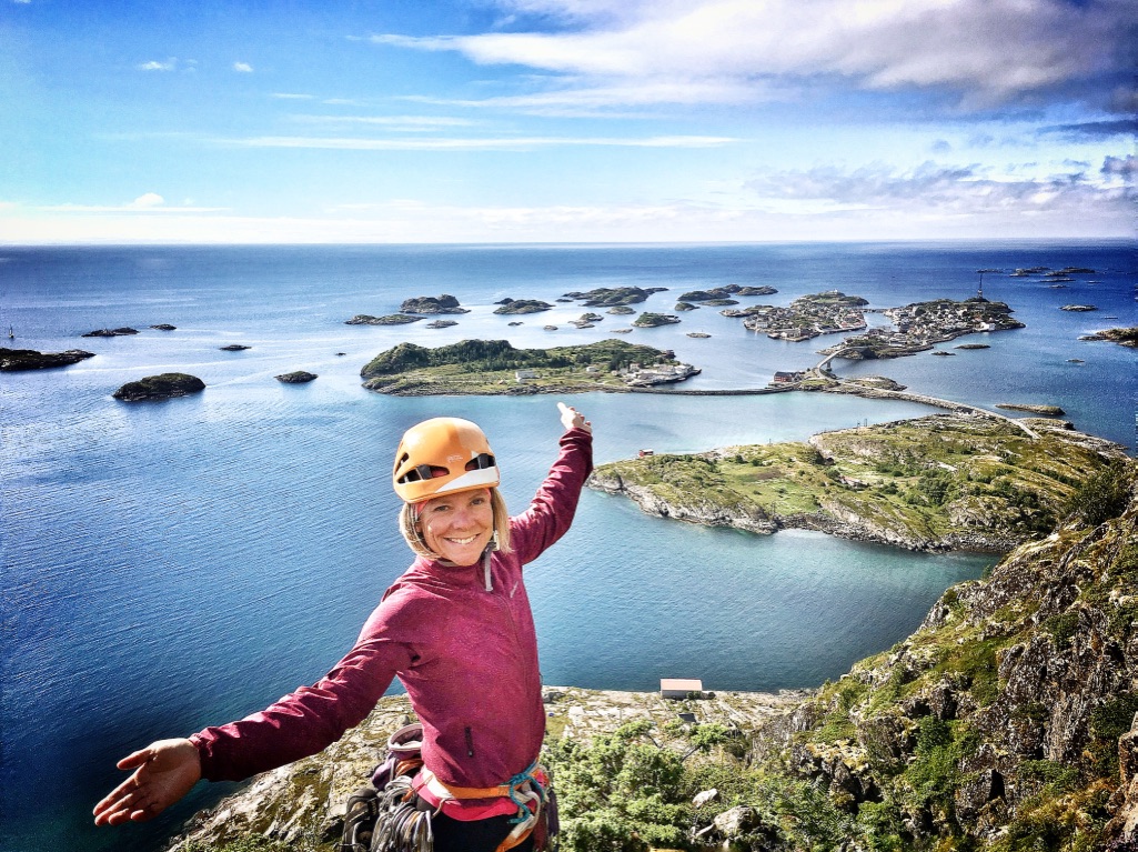
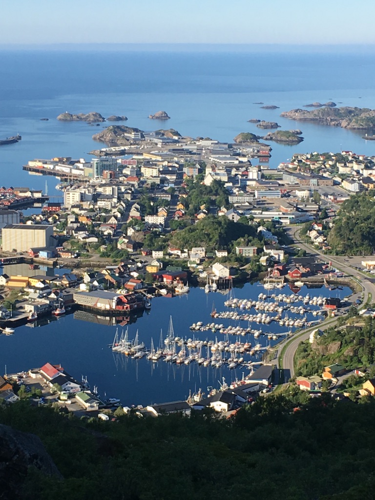
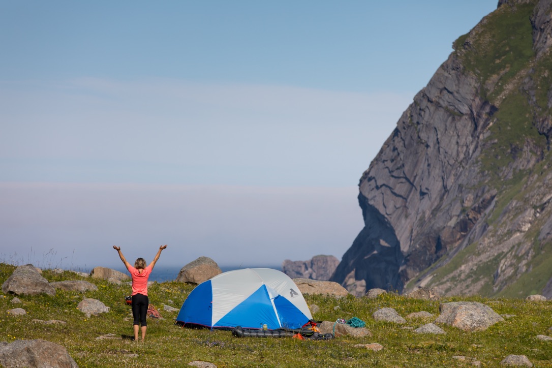
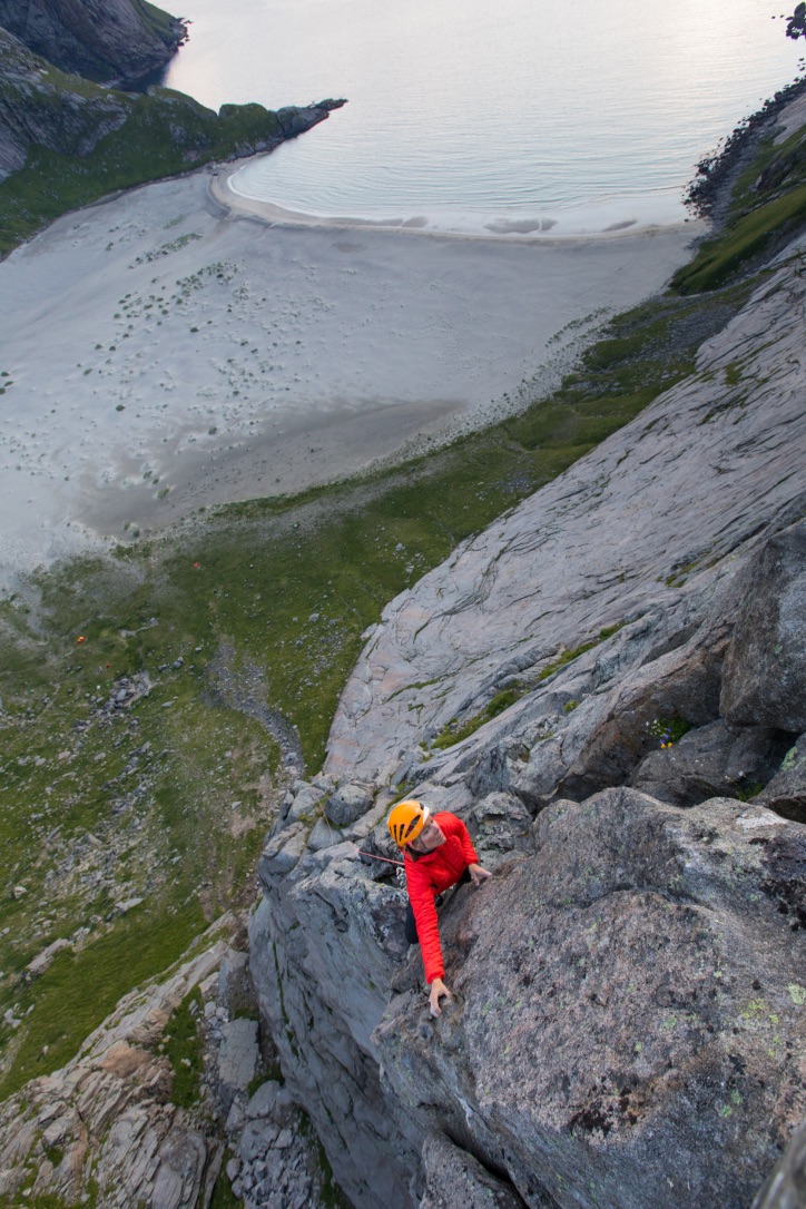
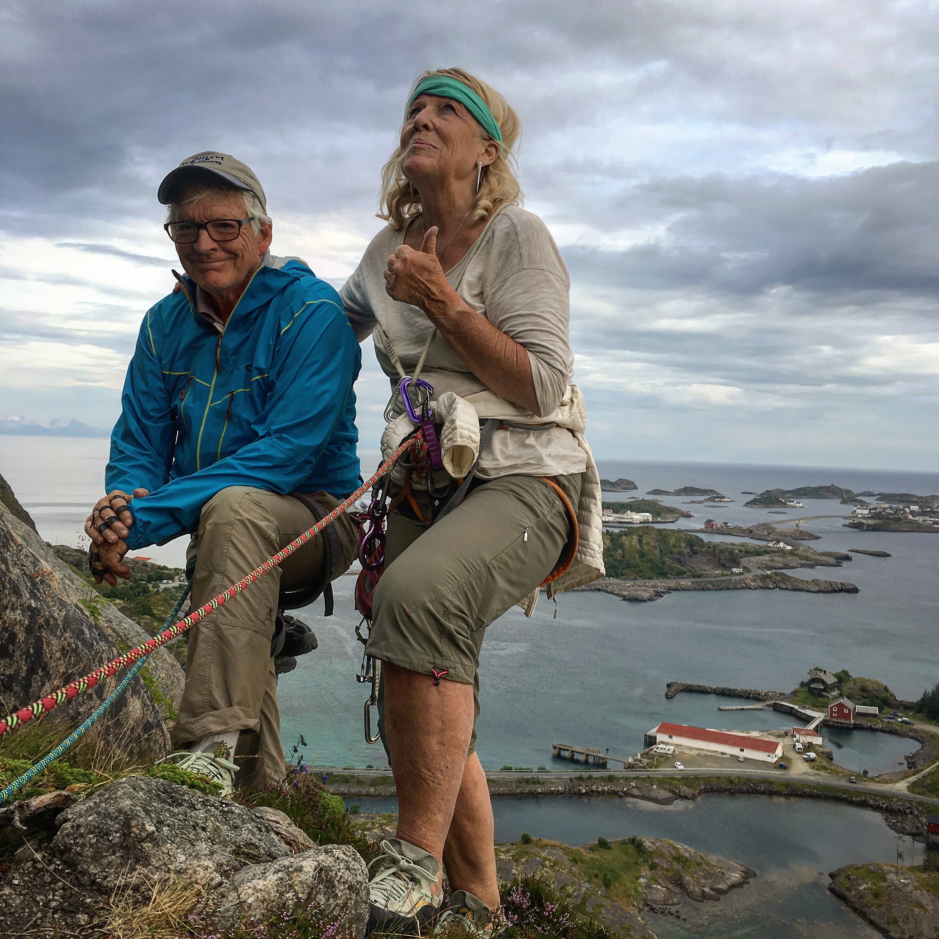
The Archipelago of Lofoten, located 200km north of the Arctic circle, offers world class climbing on granite peaks rising abruptly from the sparkling blue waters of the Norwegian Sea. It is truly one of the most magical and unique climbing adventure you can experience! I was first in Lofoten for ski touring and was struck by the beauty of the rock and its landscape. Reality was even better than what I had foreseen: perfect cracks, routes of all lengths and for all level, breathtaking views to the surrounding sea, delicious food and beautiful and typical little villages.
Get a taste of what climbing in the midnight sun looks like in this beautiful movie we shot last summer during 10 days of perfect weather in Lofoten! Sjo Tarn.
Contact us to book your rock climbing adventure in Lofoten!

Outdoor Research “Warrant” Gloves
 Gloves are one of the the most important, yet least talked about pieces of gear for ice climbing. You need a pair of gloves that will keep your hands warm and still offer good dexterity. Normally I climb with a really light pair of gloves and carry a warmer pair for the belays. This year I have done a lot of days on the ice in temps hovering in the single digits and my normal lightweight gloves (OR Stormtracker) were just not cutting it! I started climbing with the Warrant and after they broke in they became my go to glove. Warm, but not too bulky, which really helps in keeping from getting pumped, and made with good quality leather so they will last more than one rappel. So, if you’re in the market for some new ice climbing gloves these are worth considering. Make sure to size them small to allow for some stretch during the break in.
Supercouloir

With a month spent rock climbing in the middle of winter (Thailand/Jordan), I feel like winter has eluded me. So, despite summer like temperatures in Chamonix this past week, I was excited to swing my tools a little more into some sweet alpine ice.
A week earlier, my partner Tania and I had tried to climb the Supercouloir but it had just snowed and huge snow mushrooms were looming high above us, making the route impossible to climb. We resorted to climbing the nearby “Goulotte Lafaille”, a 400m long ice route on the Mont Blanc du Tacul (4248m). We made quick work of it, simul-climbing most of the route. The next day, I left on a Haute Route, guiding 4 amazing British lads from Chamonix to Zermatt. Upon returning, the weather proved to be – yet again – beautiful and we decided to get back on the Supercouloir.
The Supercouloir was first climbed in 1975 (before I was born!). This rock/ice line is the most striking feature on the east face of Mont Blanc du Tacul. It is nestled between two beautiful pillars, one of which is the worldclass Gervasutti pillar. I had climbed this route in 2003, via the direct start, which is no longer in condition at this time of year. It was my partner’s dream to climb this route and I was excited to do it with her. Tania is full time doctor and was on the guide course with me in Switzerland. We have climbed extensively together in the past, but since my departure to the States, we were lucky if got to do one outing a year together. Recently though, we have made up for lost time.
We slept at the Cosmiques Hut – a beautiful refuge only 15minutes away from the top of the Aiguille du Midi cable car. We reached the base of the route by dawn. The sun hadn’t touched the rock yet and it was very cold to touch and was still covered in ice in places. I had to resort to using an ice axe to make it up the iced up slab/super thin crack. I led two pitches in one and reached the now bolted anchor, greeted by the sunshine. We climbed in rock slippers, hauling a pack loaded with our ice climbing gear: crampons, ice axes, boots, ice screws, jackets, gloves, etc.). We made quick work of the remaining 3 pitches taking us to the bottom of a left slanting snow ramp, which took us to the ice. We switched to our ice climbing gear, left the rock gear and climbing slippers at the anchor and made our way to the ice. We climbed the 300m long ice climb in two pitches, simul-climbing 3-4 pitches at a time. By noon, we started rapping down the route, excited to get back to the sun. Although temperatures were nearing 80F in the valley, a cold breeze running down the climb made it feel like we were in an icebox.
We skied down the classic Vallee Blanche in order to catch the Montenvers train. This is the first time that I had to carry my skis to reach the train. Because of the incredible heat in Chamonix right now, we have lost 10cm of snow per day and the mountains look like it’s mid-June! But ice conditions up high are still good and am excited to have a late warm winter season, making ice climbing just a little more pleasant.
[nggallery id=3]
Drus North Couloir

Les Drus, The Drus. A beautiful granite monolith that stands proud above the Chamonix valley, burning like a flame as the sun sets down on it.

There is no easy way up the Drus. There is no easy approach to it either. It’s a mountain that you have to earn. I first climbed it back in 2001, upon graduating from law school. I was with my brother and we had wanted to climb the American Direct, a stunning line up the center of the west face. We had little experience and carried way too much with us – we had over 5liters of water for our bivouac half way up the face! – and we didn’t make it to the summit. The route doesn’t end at the summit, but with a mountain like the Drus, the top matters. I had always wanted to get back on the Drus. In 2003, I climbed the north faces of the Eiger, the Matterhorn and the Grandes Jorasses, all in just over three months. A week later, I was climbing the north face of the Piz Badile, another one of the six great north faces. I was hoping to climb all six in six months, but that summer had been very dry and the Drus was falling apart. An ascent of its north face would have been suicidal. I tried the north face of the Cima Grande too. We left after work on a Friday evening, drove 8hours to Cortina d’Ampezzo and tried to climb the route the following day. It was already late in the fall and very cold, but moreover, the local rescue team was conducting a training, rapping 300m down the face. Their ropes were hitting the face, triggering lots of rock falls. We had to bail and drive back to be on time for work the next day. I hadn’t given that project much thought until this summer.

With a very wet August in the Alps, I figured conditions were going to be amazing for early season ice climbing in the mountains. I didn’t have a precise idea as to what I wanted to climb. Adam was desperately looking for a partner to climb the north face of the Eiger but I had no real interest in climbing it again, I had been working non stop, guiding pretty long routes back to back and felt that I needed to rest more than go climb a big face. But since he couldn’t find anyone, I motivated to go with him and started to look forward to a bivouac on the face. Yet at the last minute, he found a partner. The next day, I woke up to intense FOMO desperately longing to do something big too. The weather was perfect, conditions were perfect and I was dealing with shuttling cars and house work instead of being in the mountains. During a failed attempt on the Lessueur route, I saw that the approach couloir to the Dru looked like it was in condition and I was excited to give it a go.

I first went with a girlfriend, Ildi Kiss, whom I hadn’t seen in a long time: we had first met competing in ice climbing world cups back in the early 2000. She hadn’t been in the mountains in a while but was motivated and it was really fun to reconnect with her and try this route with her. We left early in the morning and simul-climbed some of the approach couloir. Things spieced up after that. I led the first mixed section and she led the second one but ended up way left of where the route was.


So, we had to lower off and climb back up to the base of the Nominee crack – a 30m long overhanging crack filled with fixed pitons. We climbed it but when we got to the top, we realized it was a little late and that we would most likely get benighted on the route if we kept going. Night falls at 6.30pm at this time of year, so we only had a few hours of daylight left and I wasn’t keen to search for rappels in the dark (the rappel route doesn’t go down the climbing route). So we rapped but I knew I would be back before I flew back to the US, providing I found a motivated partner. I couldn’t pass up the perfect conditions on the route and the beautiful Indian Summer.

The crux indeed proved to be the lack of partners: people were either down south rock climbing, or working, or on expeditions and no one was really motivated to hike up there when you can access it more easily on skis in the winter. I guided the Midi-Plan traverse on the day following our return from the Drus. On the way back, I got a message from my friend Ueli Steck saying that he was really motivated to climb this route with me. I was bursting at the seams with excitement: not only I had a solid partner, but I also knew we would for sure make it to the top! My only worry was that I was worked from too many big days in the mountains and from lack of sleep, but motivation was all I really needed to get me up the climb. The body would follow.


We met the following afternoon at the Montenvers train station to sort out gear. We hadn’t seen each other in a few years and it was fun to catch up as we hiked back up to the bivouac. We made good time hiking through the heinous talus field and reached the rocky knob at the base of the Drus in 2h30. We weren’t alone. Another party was going to climb the Lessueur route and two others were going for the same route as us. Since it’s an ice climb, we didn’t want to have anyone ahead of us, so we got up at 1am to start up the route.


There was no moon, so it was pitch black out, but I knew the way and thought I could figure it out in the dark. Ueli led out and went off route pretty much right away, but it enabled us to climb a pretty fun pitch, so that was all good. We rapped down it and I led to the start of the difficulties. It was still dark when we got to the Nominee crack.


Ueli led it in style, freeing this very steep/slightly overhanging crack. I so wished I would have had monopoints to free it too, but with dual points, I couldn’t reach inside the crack and my feet would skit, so I resorted to stepping on some of the pins. Two more sustained traversing rock pitches with rotten ice and lots of wideness took us to the base of the ice couloir.


From there, we found perfect ice to the top. We simul-climbed it in two sections and made it to the Breche des Drus, embracing the sunshine. We kept going to the “antecime” of the Petit Dru, sorted out the gear and started back down to the Breche des Drus.

We had to build V-Threads (ice anchors) on the way down as there weren’t any, which made us think that we might have been the first to top out the route this season.

I lost count of the number of rappels we did down the 800m long face, but we were back at the bivouac by 3.15pm. After a little

soup, we packed our stuff and made our way back down to Chamonix. The train had closed for the season, so we were forced to hike all the way down to the valley floor. We were down when the bells rung 7pm.
The north couloir of the Drus is the best climb I have done in a long time. It was sustained and varied, with lots of ice and mixed terrain. It’s one of those routes I could do over and over again! Of all the peaks in Chamonix, the Drus is the most striking and proud one. It’s every alpinist’s dream to tick this one off and I was all the more happy to reach the top by climbing this stunning line! It felt good to want a climb this badly again. I have spent the past couple of years focused on getting my IFMGA certification, almost forgetting about the lines that had haunted my dreams. Climbing the Drus has enabled me to reconnect to who I was before I decided to become a guide: an extremely motivated alpinist, climber and ice climber. I am already looking forward to the next big climb!

The Bietschhorn

Once upon a time, the Bietschhorn was a 4000m peak. This mountain reigns proudly on the northern slopes of the Valais and is the only snowcapped mountain visible from anywhere in the Rhone Valley. Its the pride of the locals. So much so that on old maps, the Bietschhorn reached 4003m. This was thanks to a local Lotschental girl who seduced the geographer who had first measured this mountain into adjusting the elevation to a number greated than 4000m. When the correct altitude – 3934m – was finally put on the maps, the local wrote a threatening letter to the President of the Swiss Confederation, vouching that “The Bietschhorn was and would remain a 4000m peak!”
I first climbed this peak in 2005 during a Swiss Alpine Club training during which we climbed most of the routes one can access from the remote Baltschiederklause hut: The north ridge of the Bietschhorn, the south ridge of the Jaggihorn and the Arete Blanchet on the Lotschentaler Breithorn. I remember being blown away by this pristing remote valley, by the Chamonix like rock quality and last but not least, by the hut keeper’s yummy butter ladden cakes. I knew I would be back.
After the Meije traverse, I had hoped to take Flo on the Obergabelhorn-Zinalrothhorn traverse. Yet, recent storms had brought too much fresh snow at higher elevations. I suggested going into the Baltschieder Valley, which is at a lower elevation and south facing. She was excited to discover a new valley in her own backyard.
The hike to the hut first follows the Bisse de Undra. The southern slopes of the Bernese Alps drop so steeply into the V-shaped Rhone valley that they hardly ever see rain. The fields are therefore deprived of any humidity. As a result, the locals built and dug water runnels to get the water flowing from the glaciers all the way to the fields.


With 1850m of elevation gain, the hike to the Baltschiederklause hut is one of the longest hikes in the Bernese Alps. After the Bisse, the trail climbs to a little ghost village where we had a nice lunch before climbing steeply through fields and moraines to the hut. We arrived just in time to see the sun setting behing the following day’s climb -The Bietschhorn – and on the Mischabel range across the valley.


We woke up the following day to stars in the pitch dark sky. Following little dotted reflectors along the trail (Yup, that is Switzerland for ya!), we walked in the stilness of the night, with no one but us on the way. We reached the glacier by day break. We put crampons on and traversed the 2km long stretch of the Ausser Baltschieder glacier to the base of the North Ridge. After climbing up really poor rock and a 300m long snow/ice face, we reached the ridge proper: a snow and ice knife-edge ridge which leads to a more rocky ridge to the summit.


The view from the summit extends southward from the Monte Rosa to the Mont Blanc range and to the north to the Bernese Oberland (Eiger, Monch, Jungfrau). We climbed back down the way we came up and were back at the hut in the early afternoon, in time for a slice of straight-out-of-the-oven cake.


We woke up the following day to gray skies. We headed anyway, hoping that clouds would burn off as forecasted. The ascent starts litteraly five minutes from the hut and climbs up perfect granite. Half way up, we were caught by a snow storm and strong winds. By then, it would have been longer to go down than to keep going to the summit. The storm died a little and we reached the summit. A quick note in the summit book and we headed down, following cairns to the start of the 6x20m rappels back to the trail.


Again, we were back at the hut in the early afternoon, but we still had a long day ahead of us, having to hike back down to the car, 1850m below. We had a bite to eat and made our way down, marvelling at the surrounding summits and already dreaming of other climbs to guide in the area: The Arete Blanchet on the Lotschentaler Breithorn and the south ridge of the Stockhorn.


Arete des Papillons (Papillons Ridge)

The Papillons Rige is a great climb on beautful rock on the Aiguille du Peigne in Chamonix. You reach the base within a 30-45min hike from the Plan de l’Aiguille – the Aiguille du Midi mid station.
Sophie is a doctor in Geneva and the mother of two little children, so she was excited to do a day climb. Last year, we did the Cosmiques Ridge together and the Papillons Ridge seemed like the natural progression. We were in the shade the whole time, which was perfect given that it’s in the 30’s in Chamonix (90F). This ridge offers just the right amount of technical climbing and an amazing view on the north face of the Aiguille du Midi and the Aiguilles Rouges across the valley.


A great day climbing in Chamonix! Merci Sophie!
Its Majesty: La Meije
Ah, La Meije!
La Meije was one of the last great peaks of the Alps to be climbed and the first to be climbed only by French people. Prior to that, English men would hire guides to take them up peaks like the Matterhorn, the Aiguille Verte, etc. So it was with great pride that 19 year old Emmanuel Boileau de Castelnau summitted with Pierre Gaspard and son on August 16, 1877. Before then, many had tried and believed it would centuaries before the peak would be climbed. Each section of the climb has a name, often related to how far the previous climber had climbed. The Pyramide Duhamel was a kairn built by Mr. Duhamel himself, to show how far he had gone. During the first ascent, the crux sections were climbing in….. SOCKS! It was many years before the peak saw a second ascent. The Meije – which in local slang means “the south” because the sun goes over it at noon” – is still to day one of the most beautiful ascents in the Alps!
The weather wasn’t looking good in Chamonix or in Switzerland, so I suggested to my friend/client Floriane to drive south where the sun is (almost) always shining. I had done the climb in 2002, but hadn’t been back to this area since, and I was as excited to guide it as I had been when I first did it. We left from the ski mecca La Grave and climbed the Enfetchores to the Breche de la Meije and down to the Promontoire Hut. The climb follows a 900m long spur/arete to the top of the Grand Pic (3983m… the highest of the Meije traverse peaks), followed by 3x50m rappels into the Breche Zigmondy. It then contours the Dent Zigmondy by traversing into the north face and climbing up cables to a notch, and continues up and down the 2, 3, 4th tooth all the way to the Doigt de Dieu – aka God’s finger. How I love the names in the Oisans – Southern Alps region! Three rappels takes you down on the glacier. From there, the tiny, tiny, tiny but ever so welcoming Aigle Hut is only 30mins away. Day three, we climbed the last summit of the Meije – The Meije Orientale – and then hiked down (loooooong ways down) to Villard d’Arene, and hitched hiked down to La Grave. It snowed overnight and we climbed the Rateau the last day in full on wintery conditions. Here is a photo album to illustrate Flo and I’s four days in the Ecrins Range.


I am taking Floriane into another amazing place this coming WE. Check back for more adventures to come!
Guiding on Rainier
Early June, Adam and I left the comfort of our Salt Lake City home to work on mighty Rainier, a 14,411ft (4,392.5m) high volcano in Washington State, for Rainier Mountain Guides (www.rmiguides.com).

We drove 15hours straight to Ashford, where RMI and its facilities are located. Lodging is provided for the guides and we share two areas: The “upscale” Ranch, and the “Farm”. It was super fun to stay with the great community of guides who work at RMI, cooking dinners or going out to dinner together.
Adam and I worked the Four Day Summit Climb (http://www.rmiguides.com/rainier/?id=3&program=4-Day-Summit-Climb), which climbs the classic Ingraham Direct route at this time of year, and later in the seaon, the Disappointment Cleaver. For the Four Day Summit Climb, we start the program with an orientation, which includes a gear check, talking about Mount Rainier’s history, conditions on the route, how the climb will unfold and what he expect of the clients.
The following day, we meet the clients at the RMI Basecamp after the daily guides meeting. We drive up to Paradise and hike to find snow to do the snow school. Right now, there is so much snow left at Paradise, that we can get on snow right away. We teach clients skills that will help them summit Rainier with a guide. This includes how to walk efficiently and safely on snow, with and without crampons, how to use an ice axe, how to self arrest, how to travel with a rope properly and how to be be efficient during breaks on the mountains. We also teach them Leave No Trace principles to keep the mountain as clean as possible and preserve the mountain as it is for future generations.

Jesse in self-arrest position
Unfortunately, there was a lot of moisture in the NW while we worked on Rainier. The weather forecast never looked great and we often had to do the snow school in the rain, or hike to Muir in the rain.

Adam and Tim in the rain on the way to Muir

The Butler House, where guides eat and sleep, and boil water for the clients.

View from the Butler House on the Gambu, where the clients sleep. On the left is the ranger’s living quarters.
The Gambu sleeps 18 clients. It’s a pretty old building that was built for temporary use a long time ago and was never taken down, so we still use it. Clients only spend a few hours in there, since we get up around midnight to climb Mount Rainier.

Inside the Gambu
Depending on the weather, we wake up clients anywhere from 11pm to 2am or even later. If the sky is clear and conditions on the mountain are good, we get up very early. We leave camp with helmet and headlamps on, crampons and harness on and ice axe in hand.

We start our climb by headlamp and walk for about an hour in the dark, crossing the Cathedral Gap and making our way to our first stop: the Ingraham Flats. This is where other guide services have their high camp. So this is a “safe” place. But this is also how far the cloud from the June 6th avalanche came down!

Ingraham Flats with sunrise on Little Tahoma

Crevasses below Cathedral Gap
On our first trip, conditions on the mountains weren’t very good. It had been snowing for a few days at Camp Muir and the wind had been howling at upper elevation. That, together with cold temperatures, made the perfect combination for an avalanche to occur. We hiked to the Ingraham Flats and had decided that we would go no further. We broke the news to our clients and explained why we were going to turn around. There were 11 people ahead of us, so it was hard for clients to understand why we wouldn’t keep going. Sometimes you wish that there would be a small benign avalanche in the distance to prove your point. We were about to dig a pit for clients to understand how the snowpack works. But as we looked up, a massive avalanche was coming down toward us. We definitely thought that it was headed for us, so we will started running. The snow was so deep though that we were not going anywhere in a hurry. So, we hunkered down expecting to get hit. But like a fist turned into a caress, we were merely sprinkled by the cloud. Adam was a little higher up than me and he saw a glove sticking out of the snow. The 11 people ahead of us had all been caught in the 300mx1200m avalanche. Adam and a few other guides (Tyler Jones and Mark Falender) dug out two more Koreans. One of them was blue already, wasn’t breathing and was unresponsive. I organized for clients to go down with another guide, Tom, so they could be out of avalanche hazard and then went up to watch over the rest of the crew to make sure no other avalanche was coming down on them.
1 person is still missing in action, and all the others survived.

Sun rising on the Ingraham Direct, after the avalanche
Recently, Adam and I decided to get a van to travel in. I guess, as you get older, comfort becomes more and more valuable, espacially when you spend so much time on the road. Sleeping in a tent gets a little old. We randomly found this super cheap VW van. I think the guy didn’t realize what he was selling, which we were happy about. I grew up travelling with my parents in these kinds of up-pop vans and loved it. I am so excited to experience that again.


The Honeycomb at Tieton 
Adam getting some laps in at Lava Point, Tieton During my stay, we tried Rainier three times. The first time, we got shut down my the avalanche. The second time, conditions were still too unstable on the mountain. But, as the saying goes, third time is the charm. We woke up to nice weather and decided to climb. We woke the clients up at midnight and headed out. By the time we hit the second rest break at the top of the Disappointment Cleaver, we were in a complete white out. But with a good track, reasonable temperature and little to no precip, we made it to the summit by 7.30am. It was nice to end the seaon up there with a summit of Mount Rainier!
Adam and I are spending the rest of the summer guiding in Europe. Stay tuned!

Guide Miles Clark psyched to be on the summit, despite winds, snow and no visibility 


Alpine Exam
Lows and high of becoming a mountain guide
Part I: Alpine Exam
As I flew back to Seattle from a summer of guiding in Europe in early August, I was really excited to explore a little more of the Cascades and check out some the routes we were going to do. I called my friend Willie Benegas to see what his plans were. He said he was going with Craig Luebben to climb the unfamed Torrent-Forbidden traverse in Boston Basin starting the following day. I told him I would come along. Since the weather didn’t look great, I bailed on them and instead headed to Leavenworth with Forest McBrian – another guide and fellow candidate.
 The weather was beautiful that day and I started regretting not going on the climb with Willie and Craig, as there was a great chance of us doing this route on the exam. I had gone on it the year before with my husband, Adam, and had hated the sheer looseness of the climb. I thought then that I didn’t need to do this climb twice and that I would just onsight it on an exam if I had to, but had no interest in doing it for myself and he had bailed.
I called Willie after coming down from the Dragontail in Leavenworth to check on how it had gone for them. I teased him, hoping for him to say that they had not been able to climb it because of the rain. Yet, he uttered in a faint voice and with his strong Argentinian accent: “No, there has been accident. Craig is dead”. I couldn’t grasp what he was saying. I must have misunderstood. I had him repeat the unthinkable. Craig Luebben – AMGA instructor, guide, mentor to many, creator of the Big Bros, writer of books, father and husband – had fallen with one of his favorite elements – ice – and had been killed by it? And Willie suffered injuries to one leg? I couldn’t wrap my head around it. I was meant to have been with them that day, on that climb. I hadn’t gone. What if I had gone with them? What if…
The news spread like fire. All the candidates on the Alpine Exam and the examiners were shell-shoked. Craig was meant to retake his exams to get his Alpine Certification with Dale Remsberg and this was the reason he had been up there that day, to train. Willie was meant to be on the exam with us, and now he wasn’t going to be there, leaving a loud void within the group. It was all very eerie. The tone for the exam was set: be aware, be conservative with the terrain. The exam started with a minute of silence for Craig and his family. A great loss we all acknowledged. A reminder of our mortality, especially up there in the mountains. With a very warm summer in the northwest this summer – temps broke a historical 100F! – conditions, as we would soon witness – had rapidly deteriorated in the mountains.
 Our group of four candidates – Dave Ahrens, Ben Mitchell, Ian Nicholson and myself – along with our examiners – Dale Remsberg and Marc Chauvin – headed up into Boston Basin, home to the Mount Torment, Forbidden Peak, Sharkin Tower, Boston Peak and Sahale. We were instantly shocked by how dry conditions were. Out of respect for Craig, the Torment Forbidden Traverse no longer was an option. We therefore headed up and over the crazily chossy Sharkin Col to camp on a col at the base of the north ridge of Forbidden. The following day, we did crevasse rescue on the glacier and went and scoped out the following day’s objective. On Day 4 (Day 1 was spent doing movement skills exams on rock: climbing a 5.10 route in shoes, 5.8 in boots and 4 class terrain speed traveling at Mount Eerie), we woke up early to climb the NW face of Forbidden (Ben, Dale and I), while Ian, Dave and Marc climbed the North Rib of Forbidden – a parallel buttress.
Crossing the moat that morning was one of those intensely scary experiences, where you feel that you should not be where you are: the only place to cross was on a thin rib of rather soft snow barely touching the rock and hanging over 500ft of void. Gloups. The once NW face of Forbidden was now a few pitches of ice, leading to broken rock and more ice. The mountain was a mere the image of itself. I led most of the day that day since I hadn’t lead on Day 2. Day 5, we climbed Sharfin Tower and left Boston Basin. The initial plan had been to swap areas with the other group – Dawn Glanc, Forest McBrian, Danny Ulhmann, Keith Garvey and Tom Hargis. They were in the Marble Creek Cirque, climbing the west arete of Eldorado and Early Morning Spire.
Yet, moats were also very dangerous there and they had almost all gotten killed by a car size boulder which fell right where they were standing only a few minutes earlier. Going in there was no longer an option. So we headed to Washington Pass, a much welcome trade-off, where beautiful weather and granite spires greeted us. Our program consisted of Cutthroat, South Early Winter Spire, Liberty Bell’s NW face, and Spontaneity Arete on the Petit Cheval. One more day of climbing around Bellingham and it was all over already.
 Time on the exam flew by with climbing, prepping for the next days climbs, writing tour plans, stress (although our examiners did an amazing job at mitigating that aspect of the exam), driving to and from places. With this year’s new rule, we now had to wait for the results. Our examiners prepared us for what to expect, yet until you see it in print, you just can’t be a 100% sure that you passed. For the “instant reward” kinda girl that I am, there just isn’t much more frustrating.
The sound of my new iPhone resonates in my car. It’s Ian Nicholson, one of my partners on our August 16-26th 2009 Alpine Exam: “Caroline, I am so happy! I passed!!!” he exclaims. Wait a minute, I wonder. How does he know. Lucky for us: the results have been published earlier than planned! I am one click away from finding out. And there it is…
As I scroll down the my.amga.com page, the word “Pass”, written next to “Alpine Exam” has never yet shone so brightly. Excitement and pride translate into a big wide grin on my face. I am one step closer! Closer to what? Well, to have this lifelong dream of mine come true: that of becoming an IFMGA (International Federation of Mountain Guides Associations) certified guide, a world-wide recognized mountain guide.
Next? As I write these words, I am in the midst of unpacking from this exam and packing for my next one: the rock exam in Vegas. After that, I’ll consider signing up for the ski exam next spring. But right now, I am just happy with having come this far. One step at a time, and now, one exam at a time…