The Bietschhorn

Once upon a time, the Bietschhorn was a 4000m peak. This mountain reigns proudly on the northern slopes of the Valais and is the only snowcapped mountain visible from anywhere in the Rhone Valley. Its the pride of the locals. So much so that on old maps, the Bietschhorn reached 4003m. This was thanks to a local Lotschental girl who seduced the geographer who had first measured this mountain into adjusting the elevation to a number greated than 4000m. When the correct altitude – 3934m – was finally put on the maps, the local wrote a threatening letter to the President of the Swiss Confederation, vouching that “The Bietschhorn was and would remain a 4000m peak!”
I first climbed this peak in 2005 during a Swiss Alpine Club training during which we climbed most of the routes one can access from the remote Baltschiederklause hut: The north ridge of the Bietschhorn, the south ridge of the Jaggihorn and the Arete Blanchet on the Lotschentaler Breithorn. I remember being blown away by this pristing remote valley, by the Chamonix like rock quality and last but not least, by the hut keeper’s yummy butter ladden cakes. I knew I would be back.
After the Meije traverse, I had hoped to take Flo on the Obergabelhorn-Zinalrothhorn traverse. Yet, recent storms had brought too much fresh snow at higher elevations. I suggested going into the Baltschieder Valley, which is at a lower elevation and south facing. She was excited to discover a new valley in her own backyard.
The hike to the hut first follows the Bisse de Undra. The southern slopes of the Bernese Alps drop so steeply into the V-shaped Rhone valley that they hardly ever see rain. The fields are therefore deprived of any humidity. As a result, the locals built and dug water runnels to get the water flowing from the glaciers all the way to the fields.


With 1850m of elevation gain, the hike to the Baltschiederklause hut is one of the longest hikes in the Bernese Alps. After the Bisse, the trail climbs to a little ghost village where we had a nice lunch before climbing steeply through fields and moraines to the hut. We arrived just in time to see the sun setting behing the following day’s climb -The Bietschhorn – and on the Mischabel range across the valley.


We woke up the following day to stars in the pitch dark sky. Following little dotted reflectors along the trail (Yup, that is Switzerland for ya!), we walked in the stilness of the night, with no one but us on the way. We reached the glacier by day break. We put crampons on and traversed the 2km long stretch of the Ausser Baltschieder glacier to the base of the North Ridge. After climbing up really poor rock and a 300m long snow/ice face, we reached the ridge proper: a snow and ice knife-edge ridge which leads to a more rocky ridge to the summit.


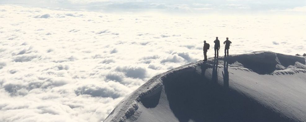
The view from the summit extends southward from the Monte Rosa to the Mont Blanc range and to the north to the Bernese Oberland (Eiger, Monch, Jungfrau). We climbed back down the way we came up and were back at the hut in the early afternoon, in time for a slice of straight-out-of-the-oven cake.


We woke up the following day to gray skies. We headed anyway, hoping that clouds would burn off as forecasted. The ascent starts litteraly five minutes from the hut and climbs up perfect granite. Half way up, we were caught by a snow storm and strong winds. By then, it would have been longer to go down than to keep going to the summit. The storm died a little and we reached the summit. A quick note in the summit book and we headed down, following cairns to the start of the 6x20m rappels back to the trail.


Again, we were back at the hut in the early afternoon, but we still had a long day ahead of us, having to hike back down to the car, 1850m below. We had a bite to eat and made our way down, marvelling at the surrounding summits and already dreaming of other climbs to guide in the area: The Arete Blanchet on the Lotschentaler Breithorn and the south ridge of the Stockhorn.